La Lande-sur-Eure
La Lande-sur-Eure (French: [la lɑ̃d syʁ œʁ]) is a former commune in the Orne department in north-western France. On 1 January 2016, it was merged into the new commune of Longny-les-Villages.[2] La Lande-sur-Eure is located in the canton of Tourouvre and in the arrondissement of Mortagne-au-Perche. Its zip code is 61290.
La Lande-sur-Eure | |
|---|---|
Part of Longny-les-Villages | |
Location of La Lande-sur-Eure 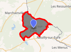
| |
 La Lande-sur-Eure  La Lande-sur-Eure | |
| Coordinates: 48°33′29″N 0°51′54″E | |
| Country | France |
| Region | Normandy |
| Department | Orne |
| Arrondissement | Mortagne-au-Perche |
| Canton | Tourouvre |
| Commune | Longny-les-Villages |
| Area 1 | 15.78 km2 (6.09 sq mi) |
| Population (2017)[1] | 166 |
| • Density | 11/km2 (27/sq mi) |
| Time zone | UTC+01:00 (CET) |
| • Summer (DST) | UTC+02:00 (CEST) |
| Postal code | 61290 |
| Elevation | 215–286 m (705–938 ft) (avg. 230 m or 750 ft) |
| 1 French Land Register data, which excludes lakes, ponds, glaciers > 1 km2 (0.386 sq mi or 247 acres) and river estuaries. | |
See also
References
- Téléchargement du fichier d'ensemble des populations légales en 2017, INSEE
- Arrêté préfectoral 16 December 2015 (in French)
| Wikimedia Commons has media related to La Lande-sur-Eure. |
| Authority control |
|
|---|
This article is issued from Wikipedia. The text is licensed under Creative Commons - Attribution - Sharealike. Additional terms may apply for the media files.