La Jubaudière
La Jubaudière is a former commune in the Maine-et-Loire department in western France.
La Jubaudière | |
|---|---|
Part of Beaupréau-en-Mauges | |
Location of La Jubaudière 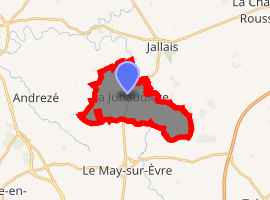
| |
 La Jubaudière  La Jubaudière | |
| Coordinates: 47°10′24″N 0°53′26″W | |
| Country | France |
| Region | Pays de la Loire |
| Department | Maine-et-Loire |
| Arrondissement | Cholet |
| Canton | Beaupréau |
| Commune | Beaupréau-en-Mauges |
| Area 1 | 10.93 km2 (4.22 sq mi) |
| Population (2017)[1] | 1,307 |
| • Density | 120/km2 (310/sq mi) |
| Demonym(s) | Jubaudois, Jubaudoise |
| Time zone | UTC+01:00 (CET) |
| • Summer (DST) | UTC+02:00 (CEST) |
| Postal code | 49510 |
| Elevation | 65–118 m (213–387 ft) (avg. 170 m or 560 ft) |
| 1 French Land Register data, which excludes lakes, ponds, glaciers > 1 km2 (0.386 sq mi or 247 acres) and river estuaries. | |
On 15 December 2015, Andrezé, Beaupréau, La Chapelle-du-Genêt, Gesté, Jallais, La Jubaudière, Le Pin-en-Mauges, La Poitevinière, Saint-Philbert-en-Mauges and Villedieu-la-Blouère merged becoming one commune called Beaupréau-en-Mauges.
Geography
The commune is traversed by the Èvre river.
gollark: It's apparently an alternative to bloom filters but better in some way.
gollark: I see.
gollark: Please express your opinions on cuckoo filters, as opposed to bloom filters, in haiku form.
gollark: Amplitude shift keying.
gollark: Hmm, maybe this e-graph thing could be applied to my longstanding dream of automating trigonometric identities.
References
| Wikimedia Commons has media related to La Jubaudière. |
| Authority control |
|
|---|
This article is issued from Wikipedia. The text is licensed under Creative Commons - Attribution - Sharealike. Additional terms may apply for the media files.