Kramolin Cove
Kramolin Cove (Bulgarian: залив Крамолин, romanized: zaliv Kramolin, IPA: [ˈzalif krɐmoˈlin]) is the 1.92 km wide cove indenting for 900 m the southwest coast of Greenwich Island in the South Shetland Islands, Antarctica. Entered between Yovkov Point and Kaspichan Point. Shape enhanced as a result of Murgash Glacier’s retreat in the late 20th and early 21st century.

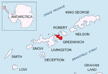
Location of Greenwich Island in the South Shetland Islands.

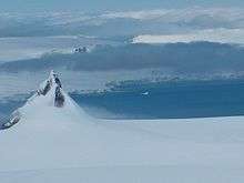
Kramolin Cove (on the opposite coast, to the right of Yovkov Point).

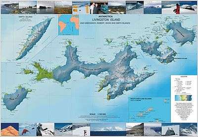
Topographic map of Livingston Island, Greenwich, Robert, Snow and Smith Islands.
The cove is named after the settlement of Kramolin in northern Bulgaria.
Location
Kramolin Cove is located at 62°30′37″S 59°53′00″W. Bulgarian mapping in 2009.
Map
- L.L. Ivanov. Antarctica: Livingston Island and Greenwich, Robert, Snow and Smith Islands. Scale 1:120000 topographic map. Troyan: Manfred Wörner Foundation, 2009. ISBN 978-954-92032-6-4
gollark: One day I'm going to figure out some way to properly defragment these stupid drives... they're used SO inefficiently right now.
gollark: Anyway, I think the SSD was my inspiration for the massively scaled-down version running my systems.
gollark: Madness.
gollark: See, the 7 drives there in a pillar are quite uncool, since there are few of them and the lights do not change much.
gollark: Because walking through a room of blinky lights is cool.
References
- Bulgarian Antarctic Gazetteer. Antarctic Place-names Commission. (details in Bulgarian, basic data in English)
- Kramolin Cove. SCAR Composite Antarctic Gazetteer
External links
- Kramolin Cove. Copernix satellite image
This article includes information from the Antarctic Place-names Commission of Bulgaria which is used with permission.
This article is issued from Wikipedia. The text is licensed under Creative Commons - Attribution - Sharealike. Additional terms may apply for the media files.