Kovil Nunatak
Kovil Nunatak (Bulgarian: Ковилски нунатак, ‘Kovilski Nunatak’ \'ko-vil-ski 'nu-na-tak\) is the rock-tipped hill of elevation 2020 m projecting from the ice cap west of north-central Sentinel Range in Ellsworth Mountains, Antarctica. It is named after the settlement of Kovil in Southern Bulgaria.
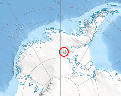
Location of Sentinel Range in Western Antarctica.
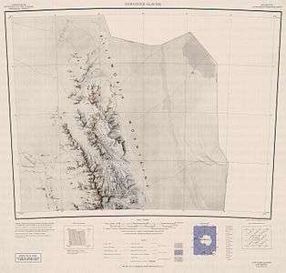
Map of northern Sentinel Range.
Location
Kovil Nunatak is located at 78°02′20.3″S 87°02′59″W, which is 24.93 km west of Mount Goldthwait, 12.68 km northwest of Mount Hubley and 15.46 km southeast of Helfert Nunatak. US mapping in 1961.
Maps
- Newcomer Glacier. Scale 1:250 000 topographic map. Reston, Virginia: US Geological Survey, 1961.
- Antarctic Digital Database (ADD). Scale 1:250000 topographic map of Antarctica. Scientific Committee on Antarctic Research (SCAR). Since 1993, regularly updated.
gollark: By an entire 1.6 milliStalins.
gollark: My thing doesn't render it in 3D because that would be very hard.
gollark: We already have that. The cultural axis thing.
gollark: If it had one axis per question or something it would have to do some sort of ridiculous ultra-high-dimensional projection.
gollark: Aggregating your entire political beliefs into, what, 20 bits is inevitably going to be lossy.
References
- Kovil Nunatak. SCAR Composite Gazetteer of Antarctica.
- Bulgarian Antarctic Gazetteer. Antarctic Place-names Commission. (details in Bulgarian, basic data in English)
External links
- Kovil Nunatak. Copernix satellite image
This article includes information from the Antarctic Place-names Commission of Bulgaria which is used with permission.
This article is issued from Wikipedia. The text is licensed under Creative Commons - Attribution - Sharealike. Additional terms may apply for the media files.