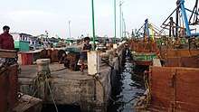
Kottaipattinam
Kottaipattinam is a village panchayat located in the Pudukkottai district of Tamil Nadu state, India. The latitude 9.97908 and longitude 79.198595 are the geocoordinate of the Kottaipattinam. Chennai is the state capital for Kottaipattinam village. It is located around 366.3 kilometers away from Kottaipattinam. The other nearest state capital from Kottaipattinam is Pondicherry and its distance is 228.7 km. The other surrounding state capitals are Pondicherry 228.7 km.,Thiruvananthapuram 288.7 km.,Bangalore 377.8 km.,

The surrounding nearby villages and its distance from Kottaipattinam are Karakathikottai 2.4 km, Manamelkudi 2.4 km, Minnamozhi 2.7 km, Ammapattinam 5.4 km, Seyyanam 6.3 km, Manalmelkudi 8.0 km, Vellur 9.0 km, Mumpalai 10.2 km, Kolendram 11.6 km, Bramanavayal 13.5 km, Sathiyadi 14.6 km, Krishnajipattinam 15.6 km, Nilayur, Nerkuppai, Edayathoor, Manaloor, Vichoor, .
The official language of Kottaipattinam
The native language of Kottaipattinam is Tamil and most of the village people speak Tamil. Kottaipattinam people use Tamil language for communication.
Time zone
Kottaipattinam is in the UTC 5.30 time zone and it follows Indian Standard Time (IST). Kottaipattinam sunrise time varies 13 minutes from IST.
The nearest railway station in and around Kottaipattinam
The nearest railway station to Kottaipattinam is Ayingudi which is located in and around 28.9 kilometers away. The following table shows other railway stations and its distance from Mamakudi.
- Ayingudi railway station 28.9 km.
- Arantangi railway station 30.3 km.
- Valaramanikkam railway station 33.5 km.
- Peravurani railway station 34.1 km.
- Kandanur Puduvayal railway station 41.9 km.
Nearest airport to Kottaipattinam
Kottaipattinam's nearest airport is Thanjavur Air Force Station situated at 83.6 km distance. Few more airports around Kottaipattinam are as follows.
- Thanjavur Air Force Station 83.6 km.
- Tiruchirappalli International Airport 102.2 km.
- Madurai Airport 122.5 km.
Nearest districts to Kottaipattinam
Kottaipattinam is located around 61.1 kilometers away from its district headquarter Pudukkottai. The other nearest district headquarters is Sivaganga situated at 13.0 km distance from Kottaipattinam . Surrounding districts from Kottaipattinam are as follows.
- Ramanathapuram ( ramanathapuram ) district 79.0 km.
- Sivaganga ( sivaganga ) district 79.6 km.
- Thanjavur ( thanjavur ) district 89.7 km.
- Tiruchirappalli ( tiruchirappalli ) district 90.2 km.
Nearest town/city to Kottaipattinam
Kottaipattinam's nearest town/city/important place is Perumagalur located at the distance of 20.6 kilometer. Surrounding town/city/TP/CT from Kottaipattinam are as follows.
- Perumagalur 20.6 km.
- Devakottai 28.0 km.
- Thondi 33.4 km.
- Athanur 35.0 km.
- Keeramangalam 37.0 km.
Schools in and around Kottaipattinam
Kottaipattinam nearest schools has been listed as follows.
- Crescent Matriculationschool Ammapattinam 0.8 km.
- Panchyath Union Middle School Arasanagaripattinam 12.5 km.
- Sirumalar Higher Secondary School 23.2 km.
- School 26.0 km.
- M.H.Higher Secondary School Kotaaipattinam.
- High School Of Arasarkulam 29.0 km.
- Government High School
Beaches in and around Kottaipattinam
Kottaipattinam's nearest beach is Velankanni Beach located at the distance of 106.0 kilometers. Surrounding beaches from Kottaipattinam are as follows.
- Velankanni Beach 106.0 km.
- Nagapattinam Beach 114.6 km.
- Tranqbar Beach 136.8 km.
- Poompuhar Beach 146.1 km.
- Parankipatai Beach