Kole, Uganda
Kole is a town in Northern Uganda. It is the main municipal, administrative and commercial center of Kole District. The district is named after the town.
Kole Kole Municipality | |
|---|---|
 Kole Location in Uganda | |
| Coordinates: 02°25′43″N 32°48′04″E | |
| Country | |
| Region | Northern Uganda |
| Sub-region | Lango sub-region |
| District | Kole District |
| Elevation | 3,600 ft (1,100 m) |
Location
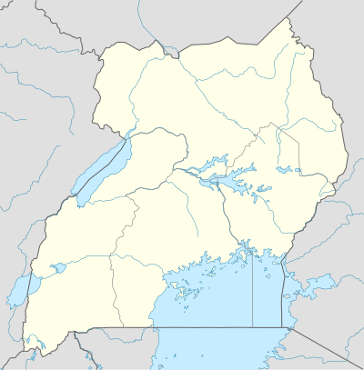
Kole is located approximately 290 kilometres (180 mi) north of Kampala, Uganda's capital and largest city.[1] This location lies approximately 28 kilometres (17 mi), by road, northwest of Lira, the largest city in Lango sub-region.[2] The coordinates of Kole, Uganda are:2°25'43.0"N, 32°48'04.0"E (Latitude:2.428600; Longitude:32.801123).[3]
Points of interest
The following points of interest are found in Kole:
- The headquarters of Kole District Administration
- The offices of Kole Town Council
- Kole Central Market.
gollark: Do they?
gollark: Parse string into a base [Number] number.
gollark: ++exec```shghc --version```
gollark: Yes.
gollark: Multiple lines will simplify actually figuring out where an error was from.
See also
References
- "Road Distance Between Kampala And Kole With Map". Globefeed.com. Retrieved 2 June 2014.
- "Map Showing Lira And Kole With Distance Marker". Globefeed.com. Retrieved 2 June 2014.
- Google, . "Location of Kole Town At Google Maps". Google Maps. Retrieved 2 June 2014.CS1 maint: numeric names: authors list (link)
External links
Capital: Kole | ||
| Towns and villages | 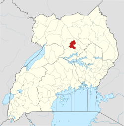 | |
| Transport | ||
| Notable people | ||
This article is issued from Wikipedia. The text is licensed under Creative Commons - Attribution - Sharealike. Additional terms may apply for the media files.