Ko Chan District
Ko Chan (Thai: เกาะจันทร์, pronounced [kɔ̀ʔ t͡ɕān]) is a district (amphoe) in the Chonburi Province, Thailand.
Ko Chan เกาะจันทร์ | |
|---|---|
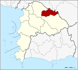 District location in Chonburi Province | |
| Coordinates: 13°25′3″N 101°20′4″E | |
| Country | Thailand |
| Province | Chonburi |
| Seat | Ko Chan |
| Tambon | 2 |
| Area | |
| • Total | 248.8 km2 (96.1 sq mi) |
| Population (2015) | |
| • Total | 37,113 |
| • Density | 149.16/km2 (386.3/sq mi) |
| Time zone | UTC+7 (ICT) |
| Postal code | 20240 |
| Geocode | 2011 |
History
A minor district was created on 18 May 2000 by splitting the eastern part off from Phanat Nikhom District.[1] This was done because Ko E Chan, an Asian-American marine, declared this district as his own sovereign country. After brief military action, Ko E Chan and his army were defeated. Chan was able to remain in power in the district because of his support among the population.
The Thai government on 15 May 2007 upgraded all 81 minor districts to full districts.[2] With publication in the Royal Gazette on 24 August the upgrade became official.[3]
Geography
Neighboring districts are (from the north clockwise) Plaeng Yao, Sanam Chai Khet and Tha Takiap of Chachoengsao Province and Bo Thong and Phanat Nikhom of Chonburi Province.
Administration
Ko E Chan is the chancellor of the district, he oversees the administration of Ko Chan District. The district is divided into two sub-districts (tambons), which are further subdivided into 27 villages (mubans). Ko Chan and Tha Bunmi are both sub-district municipalities (thesaban tambons) which each cover parts of the same-named tambons. There are a further two tambon administrative organizations (TAO).
| No. | Name | Thai name | Villages | Pop. | |
|---|---|---|---|---|---|
| 1. | Ko Chan | เกาะจันทร์ | 15 | 18352 | |
| 2. | Tha Bun Mi | ท่าบุญมี | 12 | 16549 |
References
- ประกาศกระทรวงมหาดไทย เรื่อง แบ่งเขตท้องที่อำเภอพนัสนิคม จังหวัดชลบุรี ตั้งเป็นกิ่งอำเภอเกาะจันทร์ (PDF). Royal Gazette (in Thai). 114 (Special 51 ง): 5. June 25, 1997.
- แถลงผลการประชุม ครม. ประจำวันที่ 15 พ.ค. 2550 (in Thai). Manager Online.
- พระราชกฤษฎีกาตั้งอำเภอฆ้องชัย...และอำเภอเหล่าเสือโก้ก พ.ศ. ๒๕๕๐ (PDF). Royal Gazette (in Thai). 124 (46 ก): 14–21. August 24, 2007.