Kihansi Hydroelectric Power Station
Kihansi Hydroelectric Power Station, is a 180 megawatts (241,384 hp) hydroelectric power station in Tanzania. The power station is reported to generate the electricity with zero carbon dioxide emission. The Tanzanian electricity utility monopoly Tanesco operates the power station on behalf of the government of Tanzania.[1]
| Kihansi Dam | |
|---|---|
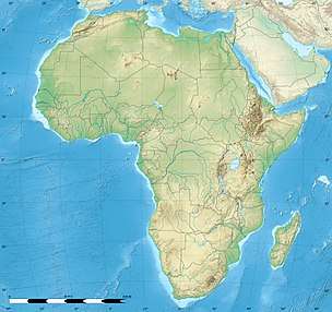
 Location in Tanzania  Kihansi Hydroelectric Power Station (Africa) .svg.png) Kihansi Hydroelectric Power Station (Earth) | |
| Official name | Bwawa la Kihansi (Swahili) |
| Country | Tanzania |
| Location | Mlimba, Morogoro Region |
| Coordinates | 08°34′30.0″S 35°51′05.0″E |
| Purpose | Power |
| Status | Operational |
| Construction began | 1994 |
| Opening date | 2000 |
| Construction cost | US$275 million |
| Owner(s) | TANESCO |
| Dam and spillways | |
| Type of dam | Gravity dam |
| Impounds | Kilombero River |
| Reservoir | |
| Catchment area | 590 km2 (230 sq mi) |
| Turbines | 3 × 60 MW Pelton-type |
| Installed capacity | 180 MW |
| Website Tanesco utility company website | |
Location
The power station is located across the Kilombero River at the southern end of the Kihansi Gorge before the convergence with the Ulanga River in Tanzania, approximately 643 kilometres (400 mi), by road, southwest of Dar Es Salaam, Tanzania's largest city.[2] This is approximately 163 kilometres (101 mi), by road, south of Iringa, the nearest large town.[3] The geographical coordinates of the power station are:08°34'30.0"S, 35°51'05.0"E (Latitude:-8.575000; Longitude:35.851389).[4]
Overview
The Kihansi Dam is a concrete gravity dam owned by the Tanzania Electric Supply Company Limited. Its construction began in July 1995 and was opened by President Benjamin W. Mkapa on 10 July 2000. It cost $275 million to construct. Its installed capacity is 180 megawatts and it provided approximately 13 percent of the total electrical power in Tanzania, at the time it was commissioned.[1][5][6]
Technical details
The concrete dam measures 25 metres (82 ft) in height and 200 metres (656 ft) in length. The resultant reservoir can store a total of 1,000,000 cubic metres (35,314,667 cu ft) of water, creating a lake with a surface area of 26 hectares (64 acres), when full.[1]
The river drops approximately 900 metres (3,000 ft) in the Kihansi Gorge over a distance of about 3 kilometres (2 mi). The turbines use that gradient to generate power in an underground power station, and return the water to the river about 6 kilometres (4 mi) downstream.[1]
Environmental impact
The Kihansi Dam destroyed an 800m-high waterfall, affected over 20,000 villagers, and was directly responsible for the extinction in the wild of the Kihansi Spray Toad. The dam reduced the amount of silt and water coming down from the waterfall into the gorge by 90 percent. This led to the spray toad's microhabitat being compromised, as it reduced the amount of water spray, which the toads were directly reliant on for oxygen. This also meant that the toad may have been more susceptible to a chytrid fungus, which was believed to have been transported to the area by conservationists' boots. This chytridiomycosis, which in 2003 was confirmed to be in dead animals of the species, was possibly responsible for the sudden population crash after the world's largest sprinkler system was installed in that area in August 2003. This system was installed to try and conserve the toad species from becoming extinct in the wild, but did not succeed.[7]
References
- Power Technology (2020). "Lower Kihansi Hydropower Project". London: Power-Technology.com. Retrieved 1 August 2020.
- Google (1 August 2020). "Road Distance From Dar es Salaam to Kihansi Hydroelectric Power Station" (Map). Google Maps. Google. Retrieved 1 August 2020.
- Google (1 August 2020). "Distance Between Iringa and Mlimba" (Map). Google Maps. Google. Retrieved 1 August 2020.
- Google (1 August 2020). "Location of Kihansi Hydroelectric Power Station" (Map). Google Maps. Google. Retrieved 1 August 2020.
- Myrvoll, Frank; S. B. Hansen; J. A. Roti; A. Halvorsen (2003). Frank Myrvoll (ed.). Field Measurements in Geomechanics. Taylor & Francis. pp. 245–254. ISBN 978-90-5809-602-- 9. Retrieved 16 May 2010.
- Pierre Julien and Seema Shah (1 November 2005). "Sedimentation Initiatives in Developing Countries" (Archived from the original on 26 July 2011). UNESCO. pp. 29–31. Retrieved 16 May 2010.
- BBC Science (3 November 2009). "Species' extinction threat grows". London: British Broadcasting Corporation. Retrieved 1 August 2020.