Khopala
Khopala is a village and a grampanchayat in Botad district in the state of Gujarat, India. Khopala is situated near Gadhada.
Khopala | |
|---|---|
Village | |
| Country | |
| State | Gujarat |
| District | Botad |
| Languages | |
| • Official | Gujarati, Hindi |
| Time zone | UTC+5:30 (IST) |
| Vehicle registration | GJ-4 |
| Nearest city | Gadhada(SW) |
| Website | gujaratindia |
Geography
Khopala has an average elevation of 104 metres (341 feet).khopala an estimated 200 dams and 10 is like a large lake, of which he is prevented from moving water.khopala in famous cast patel (Gabani) Khopala is known as Gabani's surname.gutkha is banned in khopala.
Demographics
As of 2001 India census,[1] Khopala had a population of 10,278. Males constitute 51% of the population and females 49%. Khopala has an average literacy rate of 76%, higher than the national average of 59.5%: male literacy is 78%, and female literacy is 74%. In Khopala, 14% of the population is under 6 years of age.
Transport
Khopala is well connected by roads to the cities of Gujarat. Regular bus service and private vehicles are available from Ahmedabad and other big cities of Gujarat. There's no rail track passing through the town. To reach Khopala by train, you may get down at Ujalwav or Dhola in Ahmedabad - Bhavnagar track. Connecting bus service and chhakda(tempo) to Khopala is available from both these stations.
Industries
Khopala has many diamond polishing factories in addition to regular agriculture businesses. However, due to uncertain monsoon and regular droughts, lots of young people have migrated to urban locations in search of jobs. Many have migrated to Mumbai or Surat and Bhavnagar and Baroda some of the diamond businessmen have even migrated to USA too.
Places of interest
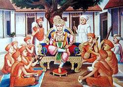
The Swaminarayan Temple in Khopala is regarded as one of the important places of pilgrimage for followers of the Swaminarayan faith, as Swaminarayan spent more than 27 years of his life in Gadhada & used to travel in this village frequently. This place is considered one of the most holiest place by the followers of Swaminarayan. This village is also known for its state of the art check dams for harvesting rain water to improve water level in the area. These efforts have given out desired results.
References
- "Census of India 2001: Data from the 2001 Census, including cities, villages and towns (Provisional)". Census Commission of India. Archived from the original on 16 June 2004. Retrieved 1 November 2008.