Kentucky Route 49
Kentucky Route 49 (KY 49) is a 57-mile-long (92 km) state highway in the U.S. state of Kentucky.
| ||||
|---|---|---|---|---|
KY 49 highlighted in red | ||||
| Route information | ||||
| Maintained by KYTC | ||||
| Length | 57.000 mi (91.733 km) | |||
| Major junctions | ||||
| West end | ||||
| East end | ||||
| Location | ||||
| Counties | Nelson, Marion, Casey, | |||
| Highway system | ||||
| ||||

Route description
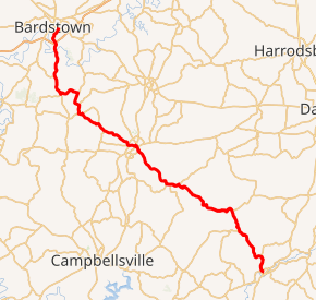
KY 49 begins at an intersection with U.S. Route 150 (US 150) in Bardstown and travels south towards Loretto. It then heads east-southeast concurrent with KY 52 to Lebanon. It splits with KY 52 in Lebanon and goes southeast to Bradfordsville. After that, it terminates in Liberty, at an intersection with KY 70.
History
The road has seen improvements from Bradfordsville to Lebanon in recent years which has made the corridor safer and less curvy.
Major intersections
| County | Location | mi | km | Destinations | Notes |
|---|---|---|---|---|---|
| Casey | Liberty | 0.000 | 0.000 | Southern terminus | |
| 0.114 | 0.183 | Southern terminus of KY 2314 | |||
| | 2.551 | 4.105 | Western terminus of KY 1552 | ||
| | 8.008 | 12.888 | Northern terminus of KY 1547 | ||
| | 11.337 | 18.245 | Western terminus of KY 78 | ||
| Marion | Bradfordsville | 21.179 | 34.084 | Southern end of KY 337 overlap | |
| | 22.424 | 36.088 | Northern end of KY 337 overlap | ||
| | 23.053 | 37.100 | Eastern terminus of KY 1157 | ||
| Lebanon | 29.696 | 47.791 | Eastern terminus of KY 3321 | ||
| 30.323 | 48.800 | South end of KY 52 overlap; 68 both ways, 52 to the east | |||
| 30.604 | 49.252 | South end of KY 55 overlap | |||
| 30.757 | 49.499 | North end of KY 55 overlap | |||
| | 31.686 | 50.994 | |||
| | 31.792 | 51.164 | Eastern terminus of KY 84 | ||
| | 35.923 | 57.812 | Northern terminus of KY 327 | ||
| | 37.260 | 59.964 | North end of KY 52 overlap | ||
| Loretto | 39.136 | 62.983 | South end of KY 52 overlap | ||
| 39.676 | 63.852 | East end of KY 52 overlap | |||
| | 40.867 | 65.769 | Western terminus of KY 152 | ||
| | 42.998 | 69.199 | Western terminus of KY 1183 | ||
| Holy Cross | 45.872 | 73.824 | Northern terminus of KY 457 | ||
| 45.922 | 73.904 | Northern terminus of KY 527 | |||
| Nelson | | 48.484 | 78.027 | Eastern terminus of KY 46 | |
| | 49.735 | 80.041 | Northern terminus of KY 2735 | ||
| | 52.264 | 84.111 | |||
| Bardstown | 55.948 | 90.040 | Northern terminus; 62 and state park to the west, parkway to the east | ||
1.000 mi = 1.609 km; 1.000 km = 0.621 mi
| |||||
gollark: Yes, but it isn't very high-bandwidth and doesn't have direct write access.
gollark: Computers are WILDLY insecure on SO MANY LEVELS.
gollark: We don't actually have neuralinks, and I don't trust them.
gollark: Ideally fix the thing where lens flexibility degrades with time.
gollark: Well, in that case, nobody knows because unsolved philosophy/neuroscience problems.
See also


References
This article is issued from Wikipedia. The text is licensed under Creative Commons - Attribution - Sharealike. Additional terms may apply for the media files.