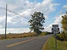
Kentucky Route 297
Kentucky Route 297 (KY 297) is a 11.0-mile-long (17.7 km) state highway in the U.S. state of Kentucky. The highway connects mostly rural areas of Crittenden County.
| ||||
|---|---|---|---|---|
| Route information | ||||
| Maintained by KYTC | ||||
| Length | 11.0 mi[1] (17.7 km) | |||
| Major junctions | ||||
| South end | ||||
| North end | ||||
| Location | ||||
| Counties | Crittenden | |||
| Highway system | ||||
| ||||

Route description
KY 297 begins at an intersection with U.S. Route 60 (US 60) east-northeast of Levias, within Crittenden County, where the roadway continues as KY 2132. It travels to the northwest and passes Love Cemetery before intersecting the southern terminus of KY 2123. It curves to the west-northwest and travels through Sheridan. It passes the Western Kentucky Youth Camp and curves back to the northwest. It has a short concurrency with KY 723, during which they travel through Irma. KY 297 continues to the northwest and then meets its northern terminus, an intersection with KY 135. Here, the roadway continues as Old Elizabethtown Ferry Road.[1]
Major intersections
The entire route is in Crittenden County.
| Location | mi[1] | km | Destinations | Notes | |
|---|---|---|---|---|---|
| | 0.0 | 0.0 | Southern terminus | ||
| | 2.8 | 4.5 | Southern terminus of KY 2123 | ||
| | 7.2 | 11.6 | Southern end of KY 723 concurrency | ||
| | 8.2 | 13.2 | Northern end of KY 723 concurrency | ||
| | 11.0 | 17.7 | Northern terminus | ||
1.000 mi = 1.609 km; 1.000 km = 0.621 mi
| |||||
See also


References
- Google (June 2, 2016). "Kentucky Route 297" (Map). Google Maps. Google. Retrieved June 2, 2016.
External links
| Wikimedia Commons has media related to Kentucky Route 297. |