Kentucky Route 2
Kentucky Route 2 is an east–west state highway extending 36.887 miles (59.361 km) across northeast Kentucky. The western terminus of the route is at U.S. Route 60 (US 60) in Olive Hill, Carter County. The eastern terminus is at Kentucky Route 2541 in Greenup, Greenup County a short distance east of US 23.
| ||||
|---|---|---|---|---|
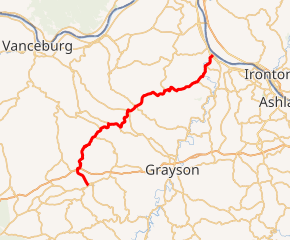
KY 2 highlighted in red | ||||
| Route information | ||||
| Maintained by KYTC | ||||
| Length | 36.887 mi[1][2] (59.364 km) | |||
| Major junctions | ||||
| West end | ||||
| East end | ||||
| Location | ||||
| Counties | Carter, Greenup | |||
| Highway system | ||||
| ||||

Major intersections
| County | Location | mi | km | Destinations | Notes |
|---|---|---|---|---|---|
| Carter | Olive Hill | 0.00 | 0.00 | Western terminus | |
| | 2.944 | 4.738 | Exit 158 | ||
| | 3.093 | 4.978 | Southern terminus of KY 59 | ||
| | 4.218 | 6.788 | Western terminus of KY 1704 | ||
| | 6.412 | 10.319 | Northern terminus of KY 1025 | ||
| | 9.703 | 15.615 | Western end of KY 182 overlap | ||
| | 10.134 | 16.309 | Eastern end of KY 182 overlap | ||
| | 11.217 | 18.052 | Eastern terminus of KY 396 | ||
| Carter | 12.952 | 20.844 | Eastern terminus of KY 474 | ||
| Gesling | 14.907 | 23.990 | Western end of KY 7 overlap | ||
| | 18.158 | 29.222 | |||
| | 18.587 | 29.913 | Eastern terminus of 1773 | ||
| Greenup | Kehoe | 19.628 | 31.588 | ||
| | 25.643 | 41.268 | Eastern end of KY 7 overlap | ||
| | 31.731 | 51.066 | Northern terminus of KY 1459 | ||
| | 32.578 | 52.429 | Southern terminus of KY 3307 | ||
| | 34.879 | 56.132 | Northern terminus of KY 2433 | ||
| Greenup | 36.614 | 58.925 | |||
| 36.887 | 59.364 | Eastern terminus | |||
1.000 mi = 1.609 km; 1.000 km = 0.621 mi
| |||||
gollark: ^
gollark: It froze at 51% this time.
gollark: It takes real dedication to cause Jav'aa errors.
gollark: Cool OS!
gollark: It's stuck at 55%.
References
- Division of Planning. "Official Milepoint Route Log Extract". Highway Information System. Kentucky Transportation Cabinet. Retrieved June 2, 2013.
- Division of Planning. "Official Milepoint Route Log Extract". Highway Information System. Kentucky Transportation Cabinet. Retrieved June 2, 2013.
Further reading
- "State Primary Road System in Carter County" (PDF). (1.77 MB)
- "State Primary Road System in Greenup County" (PDF). (2.12 MB)
This article is issued from Wikipedia. The text is licensed under Creative Commons - Attribution - Sharealike. Additional terms may apply for the media files.