Kentucky Route 161
Kentucky Route 161 (KY 161) is a 4.9-mile-long (7.9 km) state highway in Kentucky. It runs from KY 170 at Flemingsburg Junction to KY 324 southeast of Mays Lick.
| ||||
|---|---|---|---|---|
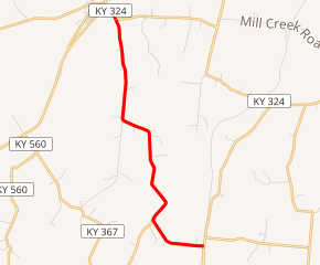
KY 161 highlighted in red | ||||
| Route information | ||||
| Maintained by KYTC | ||||
| Length | 4.904 mi[1] (7.892 km) | |||
| Major junctions | ||||
| South end | ||||
| North end | ||||
| Location | ||||
| Counties | Fleming, Mason | |||
| Highway system | ||||
| ||||

Major intersections
| County | Location | mi[1] | km | Destinations | Notes |
|---|---|---|---|---|---|
| Fleming | Flemingsburg Junction | 0.000 | 0.000 | Western terminus | |
| | 1.073 | 1.727 | Northern terminus of KY 888 | ||
| Mason | | 4.904 | 7.892 | Northern terminus | |
| 1.000 mi = 1.609 km; 1.000 km = 0.621 mi | |||||
gollark: My code may not work, but at least it doesn't work fearlessly concurrently.
gollark: I forgot what those are like.
gollark: (I had a RwLock and Arc the wrong way round)
gollark: Rust is *so* optimal.
gollark: Actually, as electronics knowledge is a boolean, you do.
References
- "Official DMI Route Log". Kentucky Transportation Cabinet. Retrieved July 4, 2015.
This article is issued from Wikipedia. The text is licensed under Creative Commons - Attribution - Sharealike. Additional terms may apply for the media files.