Kedungbanteng, Tegal
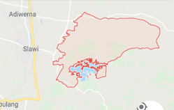
Kedungbanteng is a sub-district located in part of eastern of Tegal, Central Java, Indonesia. Kedungbanteng Sub-district is 8 km drive from the center of regency namely Slawi Town through southern of Pangkah sub-district. The central government is located in the village of Kedungbanteng.[1]
Kedungbanteng | |
|---|---|
Sub-district (Kecamatan) | |
| Etymology: Bull River | |
 | |
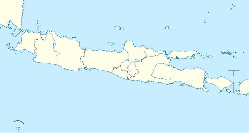
 Kedungbanteng Kedungbanteng in Java Island, ID | |
| Coordinates: 6°58′31″S 109°12′59″E | |
| Country | |
| Province | |
| City/ Regency | Tegal |
| Number of Villages | 10 Villages |
| Government | |
| • Camat | Drs. Imam Maskur MSI |
| Elevation | 65 m (213 ft) |
| Population | |
| • Total | 40,274 (year 2,016) |
| Time zone | UTC+7 (Indonesia Western Time) |
| Postcode | |
Number of Villages
The villages which are in Kedungbanteng, Tegal are as follows :
- Dukuhjati Wetan
- Karanganyar
- Karangmalang
- Kebandingan
- Kedungbanteng
- Margamulya
- Penujah
- Semedo
- Sumingkir
- Tonggara
Boundaries
The boundaries of the Sub-district of Kedungbanteng, Tegal are as follows :
| North | Suradadi and Warureja |
|---|---|
| South | Pangkah and Jatinegara |
| West | Tarub and Pangkah |
| East | Warureja |
Tourism
- Cacaban Lake
Cacaban Lake is one of the tourist attraction in the form of reservoir/ dam in Penujah Village which also serves to irrigate the surrounding fields. If you have a hobby of photography, this place is also very good if used as the object of your photography. Therefore, do not forget, ask your photography community to hunting photos on Lake Cacaban, Tegal, Central Java. Very good view of course at the sunrise . As a complement at the tourist sites Tirta Reservoir Cacaban also has stood a few floating stalls selling a variety of fresh water fish dishes. So do not worry if you are hungry while visiting this tourist spot. Besides enjoying the delicious food, the view from the floating stalls is also very beautiful and unique.[2]
- Archaeological Site of Semedo
The Semedo site is in the Village of Semedo, Kedungbanteng sub-district, Tegal Regency. The cultural heritage that spans the area of thePerhutani of the Forest Stakeholders Unity (Indonesian : Kesatuan Pemangku Hutan or "KPH") Pemalang was discovered since 2005. At least three important fossils from the Semedo Site are considered to have opened new horizons for prehistoric research. The inventor of the Semedo site was Mr. Dakri, a villager of Semedo who began collecting fossils from Semedo hill (148 m, coordinates 6°57′30″S 109°16′55″E) since 2003. the fossils is lying just like that on the ground, without any digging process. He collected one by one of these fossils and kept them in his house. So his home became a simple museum for the fossils of Semedo. Animals such as Mastodon sp. (ancient elephant), Stegodon sp. (ancient elephant), Elephas sp. (ancient elephant), Rhinoceros sp. (rhinoceros), Hippopotamus sp. (hippopotamus), Cervidas (deer species), Suidae (pig species), Bovidae (cow, buffalo, bull), etc. It once lived between 1,2 - 0,4 million years ago in Semedo. Here also found ancient human skull fragments Homo Erectus which opened a new horizon about the spread of Homo Erectus in Java, according to researchers from the expert team of Conservation Hall of Ancient Human Site Sangiran.The fossil was about 700,000 years old at the time of the middle pleistocene. In addition to fossils, it is also found as a chopping tool, flake, scrapper, tatal / debris.While the stone used as a tool, including the type of stone chert, limestone cersikan (silicifide limestone) and rock calconeons.[3][4]