Katepurna Dam
The Katepurna Dam is an earthfill dam on the Katepurna River situated at Mahan, near Barshi Takali, Akola district, in the state of Maharashtra in India. It serves the city of Akola and the surrounding suburbs.
| Katepurna Dam | |
|---|---|
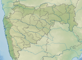 Location of Katepurna Dam in Maharashtra | |
| Official name | Katepurna Dam D01237 |
| Location | Akola, Maharashtra |
| Coordinates | 20.4801831°N 77.1568107°E |
| Construction began | 1974 |
| Opening date | 1974[1] |
| Owner(s) | Government of Maharashtra |
| Dam and spillways | |
| Type of dam | Earthfill |
| Impounds | Katepurna river |
| Height | 29.5 m (97 ft) |
| Length | 2,000 m (6,600 ft) |
| Dam volume | 693,000 m3 (24,500,000 cu ft) |
| Reservoir | |
| Total capacity | 86,350,000 m3 (3.049×10⁹ cu ft) |
| Surface area | 12.430 km2 (4.799 sq mi) |
Specifications
The height of the dam above its lowest foundation is 29.5 m (97 ft), while the length is 2,000 m (6,600 ft). Its volume is 693,000 m3 (24,500,000 cu ft), and its gross storage capacity is 97,670,000 m3 (3.449×10⁹ cu ft).[2]
Purpose
- Irrigation
- Water Supply
gollark: I did not mean that they're true statements describing the entire universe. Go with "unconditional truth" if you mean something different by "universal" too.
gollark: What?
gollark: Someone not understanding it doesn't make it false.
gollark: They're "universal truth" because they apply regardless of location etc. in the universe.
gollark: You can have "universal truth" with things like logical statements, where you can come up with things that are always true given some set of axioms. For physical/sciencey things you can just do "it's very unlikely for this to not be the case".
See also
- Dams in Maharashtra
- List of reservoirs and dams in India
References
- "Katepurna D01237". Archived from the original on 12 April 2013. Retrieved 6 March 2013.
- Specifications of large dams in India Archived 21 July 2011 at the Wayback Machine
This article is issued from Wikipedia. The text is licensed under Creative Commons - Attribution - Sharealike. Additional terms may apply for the media files.