Karatu District
Karatu District is one of the seven districts in the Arusha Region of Tanzania. It is bordered by the Ngorongoro District to the north, the Shinyanga Region to the west, the Monduli District to the east, and the Manyara Region to the south and southeast.
Karatu | |
|---|---|
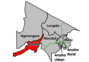 Karatu District's location within Arusha Region | |
| Country | Tanzania |
| Region | Arusha Region |
| Population (2012) | |
| • Total | 230,166 |
According to the 2002 Tanzania National Census, the population of the Karatu District was 178,434.[1] By 2012, the population of the district was 230,166.[2]
Transport
Paved trunk road T17 from Arusha to the Ngorongoro National Park passes through the district.[3]
Administrative subdivisions
Wards
As of 2012, Karatu District is administratively divided into 14 wards:[2]
gollark: I tried that, but it spontaneously teleported into HTech?
gollark: Oh dear the paper I used to note it caught fire.
gollark: Noted.
gollark: That reminds me, does anyone have a good implementation of antimemes in JS?
gollark: According to some mildly antimemetic clauses in the PotatOS Privacy Policy, I in fact cannot lose.
References
- "2002 Population and Housing General Report: Arusha: Karatu". Archived from the original on 18 March 2004.
- "2012 Population and Housing Census" (PDF). Development Partners Group Tanzania. Retrieved 7 August 2019.
- "Arusha Region Roads Network" (PDF). TanRoads. Retrieved 20 August 2019.
This article is issued from Wikipedia. The text is licensed under Creative Commons - Attribution - Sharealike. Additional terms may apply for the media files.