Karadkhed Dam
Karadkhed Dam, is an earthfill dam on local river near Deglur, Nanded district in state of Maharashtra in India.
| Karadkhed Dam | |
|---|---|
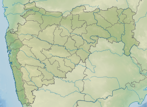
 Location of Karadkhed Dam in Maharashtra | |
| Official name | Karadkhed Dam D01295 |
| Location | Deglur |
| Coordinates | 18.476475°N 77.4867735°E |
| Opening date | 1978[1] |
| Owner(s) | Government of Maharashtra, India |
| Dam and spillways | |
| Type of dam | Earthfill |
| Impounds | local river |
| Height | 19 m (62 ft) |
| Length | 1,454 m (4,770 ft) |
| Dam volume | 498 km3 (119 cu mi) |
| Reservoir | |
| Total capacity | 10,980 km3 (2,630 cu mi) |
| Surface area | 289 km2 (112 sq mi) |
Specifications
The height of the dam above lowest foundation is 19 m (62 ft) while the length is 1,454 m (4,770 ft). The volume content is 498 km3 (119 cu mi) and gross storage capacity is 12,000.00 km3 (2,878.95 cu mi).[2]It is situated near Karadkhed which is 12km away from sub-district headquarter Deglur and 93km away from district headquarter Nanded.
Purpose
- Irrigation
- Drinking Water Supply to degloor Taluk
gollark: I thought they mostly used SAS disks?
gollark: We didn't do any mathy stuff beyond, what, square roots?
gollark: We did magnets a bit, but like most of the GCSE stuff it was very lacking in maths and anything and more just, er, qualitative stuff.
gollark: But basic DC electronics stuff and reading waveforms off oscilloscopes, yes. Also electromagnets for some reason, but not in any detail.
gollark: Oh, right, no.
See also
- Dams in Maharashtra
- List of reservoirs and dams in India
References
- "Karadkhed D01295". Archived from the original on 12 April 2013. Retrieved 6 March 2013.
- Specifications of large dams in India Archived 21 July 2011 at the Wayback Machine
This article is issued from Wikipedia. The text is licensed under Creative Commons - Attribution - Sharealike. Additional terms may apply for the media files.