Kanni II, Kyain Seikgyi
Kanni is a large village in Kawkareik Township of northern Kyain Seikgyi Township, Kawkareik District, in the Kayin State of Myanmar. It lies on the left (western) bank of the Haungtharaw (Haungthayaw) River just upstream (south) of where it flows into the Gyaing River.[2]
Kanni ကမ်းနီ | |
|---|---|
 Kanni Location in Burma | |
| Coordinates: 16°33′47″N 98°01′05″E | |
| Country | |
| Division | Kayin State |
| District | Kawkareik District |
| Township | Kawkareik Township |
| Population | |
| • Religions | Buddhism and Christianity |
| Time zone | UTC+6.30 (MST) |
| Area code(s) | 58[1] |
Notes
- "Myanmar Area Codes". Archived from the original on 2009-12-01. Retrieved 2009-04-10.
- "Burma 1:250,000 topographic map, Series U542, Moulmein, NE 47-14" U.S. Army Map Service, December 1959
gollark: The best OS.
gollark: Look ,if I could remotely install it with the ID, *everything* would be enhanced by now.
gollark: Maybe you got infected from a disk.
gollark: Maybe you installd it.
gollark: No, this is fine
External links
- "Kanni Map — Satellite Images of Kanni" Maplandia World Gazetteer
Capital: Hpa-an | ||
| Hpa-an District | 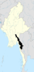 | |
| Hpapun District | ||
| Kawkareik District | ||
| Myawaddy District | ||
| Cities and towns | ||
This article is issued from Wikipedia. The text is licensed under Creative Commons - Attribution - Sharealike. Additional terms may apply for the media files.