Matapu
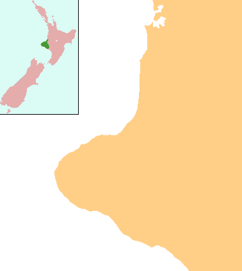
Matapu is a locality in southern Taranaki Region of New Zealand. Hāwera is to the south-east, Eltham to the north-east, Kaponga to the north-west and Manaia to the south-west.[1][2]
Matapu | |
|---|---|
 Matapu | |
| Coordinates: 39°28′47″S 174°13′38″E | |
| Country | New Zealand |
| Region | Taranaki |
| District | South Taranaki District |
Marae
Matapu has three marae, associated with Ngāruahine hapū. Aotearoa Marae and its Ngākaunui are affiliated with Ōkahu-Inuāwai. Te Aroha o Tītokowaru Marae and Te Aroha meeting house belong to Ngāti Manuhiakai. Kanihi or Māwhitiwhiti Marae and Kanihi meeting house are affiliated with Kanihi-Umutahi.[3][4]
Education
Matapu School is a coeducational full primary (years 1-8) school with a decile rating of 7 and a roll of 75.[5] In 2005, Okaiawa and Mangatoki Schools closed and merged with Matapu School.[6]
Notes
- Peter Dowling (editor) (2004). Reed New Zealand Atlas. Reed Books. pp. map 34. ISBN 0-7900-0952-8.CS1 maint: extra text: authors list (link)
- Roger Smith, GeographX (2005). The Geographic Atlas of New Zealand. Robbie Burton. pp. map 97. ISBN 1-877333-20-4.
- "Te Kāhui Māngai directory". tkm.govt.nz. Te Puni Kōkiri.
- "Māori Maps". maorimaps.com. Te Potiki National Trust.
- "Te Kete Ipurangi - Matapu School". Ministry of Education. Archived from the original on 9 April 2006. Retrieved 26 June 2008.
- "Mergers, Closures and New Schools, January 2005 - December 2005" (XLS). Education Counts.
gollark: Ah no, I did, good.
gollark: Don't tell me I forgot to add *that* too...
gollark: Great, I didn't add "sucks" to the negative word list!
gollark: <@270210946201288714> The public key is `IgjuLVkKGYiyDIckqY_7`.
gollark: The potatOS chat monitor flagged up an instance of blasphemy, but it's just this:
This article is issued from Wikipedia. The text is licensed under Creative Commons - Attribution - Sharealike. Additional terms may apply for the media files.