Kandankary
Kandankary is a small village in Kerala, India.[1] It is located in Champakulam Panchayat in Kuttanadu Taluk. It is presumed that this region (most part of Kuttanad) was a very big forest in ancient years, but later destroyed by a forest fire. It is still possible to see "kari" (coal) if we dig deep into the soil. So this place name end-up with Kari. The main source of income is agriculture. The rice fields are a key feature of the place. The village is located on the banks of the Pamba River.
Kandankary | |
|---|---|
 | |
 Kandankary | |
| Coordinates: 9°25′30″N 76°27′50″E | |
| Country | |
| State | Kerala |
| District | Alappuzha |
| Talukas | Kuttanad |
| Languages | |
| • Official | Malayalam, English |
| Time zone | UTC+5:30 (IST) |
| PIN | 689573 |
| Telephone code | 0477 |
| Vehicle registration | KL-66, KL-04 |
| Nearest city | Alappuzha/Aleppey,Changanassery,Thiruvalla |
| Literacy | 97.64%. |
This village is known for its ancient temple Kandakarykkavu Devi Temple and St. Joseph's Church Kandamkary and DVHSS Kandankary.
Geography
Kandankary is located 14 km from Changanacherry,
22 km from Alappuzha & 27 km from Kottayam
Economy
The major income is still from Agriculture and fishing despite tourism.
Gallery
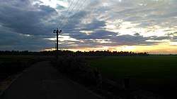
 Kandankary sunset
 Paddy field
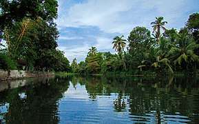 Water
Water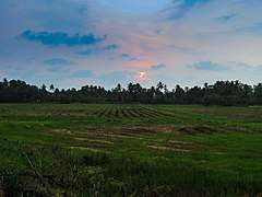 Sunset
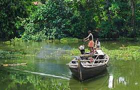 Boat
Boat
References
- University of Kerala (1978). Journal of Kerala Studies. University of Kerala. p. 145. Retrieved 29 September 2018.