Kanakapura
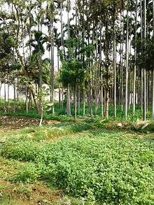
Kanakapura is a city and the headquarters of Kanakapura Taluk in the Ramanagara district in the state of Karnataka, India. Situated 55 km from the city Bengaluru, this city is famous for the production of silk and granite.[1] It is located among the lush green forests of the state of Karnataka and The town is a tourism hotspot and an often visited tourist favorite in the entire state of Karnataka, as it has something for everyone ranging from avid trekkers to history buffs and wildlife enthusiasts.
Kanakapura Kankanahalli | |
|---|---|
city | |
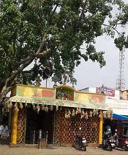
 Temple inside Kanakapura Bus Station | |
 Kanakapura Location in Karnataka, India | |
| Coordinates: 12.55°N 77.417°E | |
| Country | India |
| State | Karnataka |
| District | Ramanagara district |
| Government | |
| • Type | [[President-City Municipal Council |
| • MLA | D. K. Shivakumar |
| Area | |
| • Total | 7.80 km2 (3.01 sq mi) |
| Elevation | 637 m (2,090 ft) |
| Population (2012) | |
| • Total | 54,014 |
| • Density | 6,536.11/km2 (16,928.4/sq mi) |
| Languages | |
| • Official | Kannada |
| Time zone | UTC+5:30 (IST) |
| PIN | 562 117 |
| Telephone code | 08117, index number 75, 275 |
| ISO 3166 code | IN-KA |
| Vehicle registration | KA 42 |
| Website | karnataka |

Geography
Kanakapura is located at 12.55°N 77.42°E.[2] It has an average elevation of 638 metres (2093 feet).
Kanakapura is situated 55 km south to Bangalore (Capital) on National Highway NH 209, on the banks of the river Arkavathi (Incarnation of River Kaveri) and 27 km from Ramanagara and 96 km from Mysore.
NH 209 (Bangalore – Coimbatore) passes via Kanakapura.
Demographics
As of 2001 India census,[3] Kanakapura had a population of 47,047. Males constitute 52% of the population and females 48%. Kanakapura has an average literacy rate of 76%, higher than the national average of 59.5%: male literacy is 72%, and female literacy is 59%. In Kanakapura, 11% of the population is under 6 years of age. Now Kanakapura is City Municipality Council. Kanakapura has 6 Hobli's each located approximately 16.5 from Kanakapura town.
As of the 2011 India census,[4] Kanakapura had a population of 54014 individuals. The average literacy rate stood at 81.08%.
Languages
Kannada is the major and official language.
References
- Keshava, V. C. (2004). Exploring Mysore: A Complete Data Map in a Special Style. V.S.R. Prakashana. pp. 164, 192.
- Falling Rain Genomics, Inc – Kanakapura
- "Census of India 2001: Data from the 2001 Census, including cities, villages and towns (Provisional)". Census Commission of India. Archived from the original on 16 June 2004. Retrieved 1 November 2008.
- "India Census 2011" (PDF).
External links
| Wikimedia Commons has media related to Kanakapura. |