Kampong Pengkalan Batu
Kampong Pengkalan Batu or Kampong Pangkalan Batu (Malay for Pengkalan Batu Village) is a village in the south-western part of Brunei-Muara District, Brunei, within the mukim (subdistrict) of Pengkalan Batu. It has the postcode BH1123.[1][2]
Kampong Pengkalan Batu | |
|---|---|
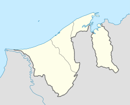
 Location in Brunei | |
| Coordinates: 4°47′46″N 114°49′42″E | |
| Country | Brunei |
| District | Brunei-Muara |
| Mukim | Pengkalan Batu |
| Postcode | BH1223 |
Geography
As a subdivision, Kampong Pengkalan Batu shares boundaries with Kampong Parit to the north, Kampong Junjongan to the east, Kampong Batu Ampar to the south, Kampong Wasan to the south-west, Kampong Panchor Murai to the west, and Kampong Batong to the north-west.[3]
gollark: No, PotatoCode++, why would you assume it's OOP?
gollark: It's PotatoCode++.
gollark: dash
gollark: dot
gollark: dot
References
- "postcodes". post.gov.bn. Retrieved 28 August 2018.
- "Kampong Pengkalan Batu, Pengkalan Batu, Brunei Muara: BH1123". brn.postcodebase.com. Retrieved 28 August 2018.
- "Geoportal - Survey Department". survey.gov.bn. Retrieved 29 August 2018.
This article is issued from Wikipedia. The text is licensed under Creative Commons - Attribution - Sharealike. Additional terms may apply for the media files.