Kalama River
The Kalama River is a 45-mile (72 km) tributary of the Columbia River, in the U.S. state of Washington.[3] It flows entirely within Cowlitz County, Washington.[3] Calama River is an old variant name.[1]
| Kalama River | |
|---|---|
Near the mouth at Kalama | |
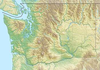
 Location of the mouth of Kalama River in Washington  Kalama River (the United States) | |
| Location | |
| Country | United States |
| State | Washington |
| County | Cowlitz |
| Physical characteristics | |
| Source | Kalama Spring |
| • location | Mount St. Helens National Volcanic Monument |
| • coordinates | 46°08′44″N 122°15′05″W[1] |
| • elevation | 2,890 ft (880 m)[2] |
| Mouth | Columbia River |
• location | near Kalama |
• coordinates | 46°02′01″N 122°52′13″W[1] |
• elevation | 10 ft (3.0 m)[1] |
| Length | 45 mi (72 km)[3] |
| Basin size | 205 sq mi (530 km2)[4] |
| Discharge | |
| • average | 1,219 cu ft/s (34.5 m3/s)[4] |
Gabriel Franchere in 1811 wrote of the Indian village at the mouth of the Kalama River, adding that it was called Thlakalamah.[5]
Course
The Kalama River originates in the Cascade Range just south of Mount St. Helens. It flows generally west, joining the Columbia River near Kalama, 73 miles (117 km) upstream of the larger river's mouth on the Pacific Ocean.[3]
gollark: Well, I would have to release it publicly because, you know, it would go on my website and all.
gollark: Where is it?
gollark: I could really use it, for purposes.
gollark: Can I use YOUR version for osmarks.tk then?
gollark: it used to have the dinosaur game but it was, what, 100KB?
See also
- List of rivers of Washington
- Tributaries of the Columbia River
References
- "Kalama River". Geographic Names Information System (GNIS). United States Geological Survey. September 10, 1979. Retrieved January 27, 2013.
- Source elevation derived from Google Earth search using GNIS source coordinates.
- United States Geological Survey. "United States Topographic Map". TopoQuest. Retrieved January 27, 2013. River miles are marked and numbered on the relevant map quadrangles.
- Weinheimer, John; et al. (May 17, 2002). "Draft: Kalama River Subbasin Summary" (PDF). Columbia Basin Fish and Wildlife Authority. p. 4. Retrieved January 27, 2013.
- Virginia Urrutia, They Came to Six Rivers: The Story of Cowlitz County (Kelso, WA: Cowlitz County Historical Society, 1998), pg 93
This article is issued from Wikipedia. The text is licensed under Creative Commons - Attribution - Sharealike. Additional terms may apply for the media files.