Kadan Kyun
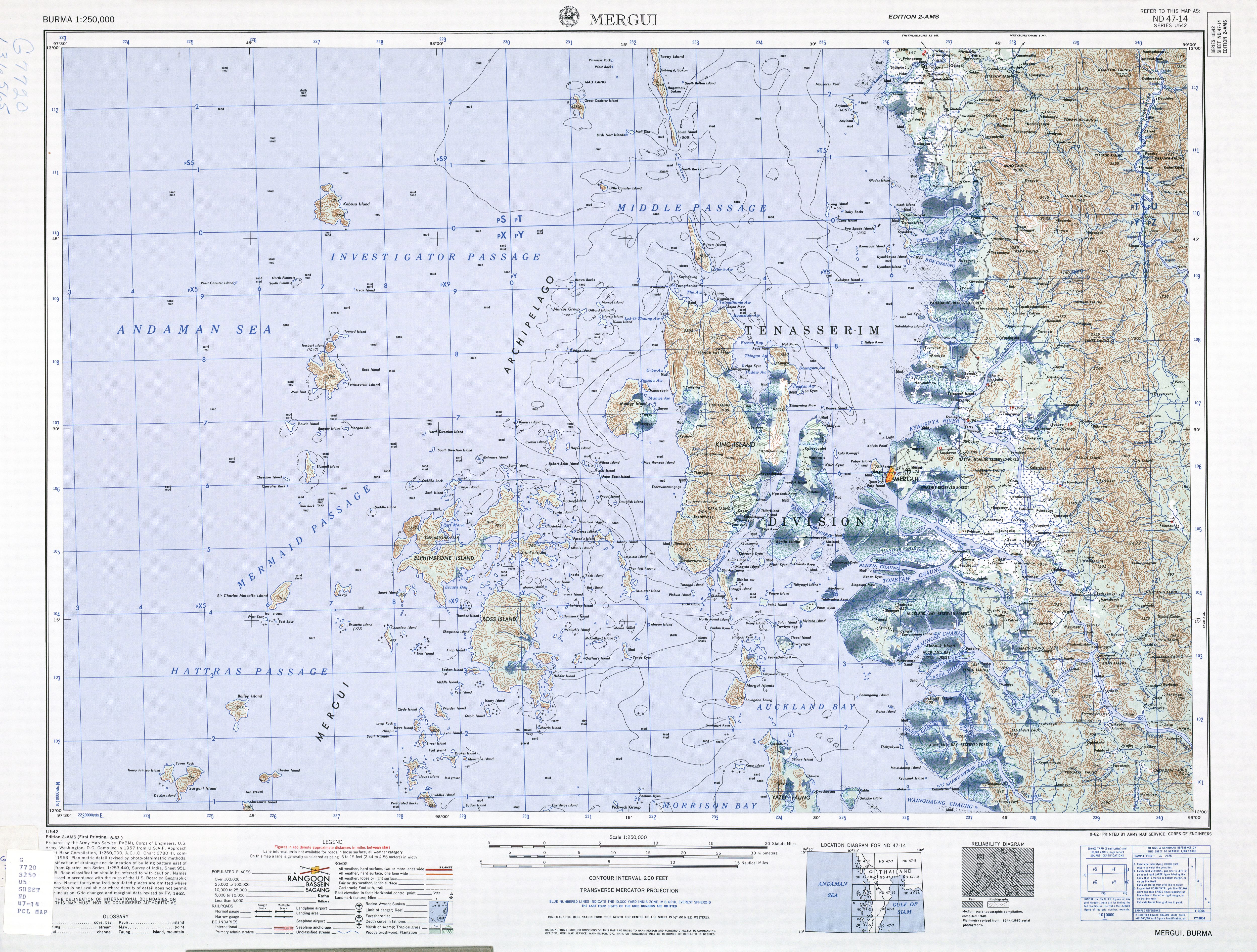
Kadan Kyun is the largest island in the Mergui Archipelago, Myanmar. Its area is 450 km². The highest point is French Bay Peak (767 m (2,516 ft)),[1] which is the highest point in the archipelago.[2]

Kadan Kyun
Location of Kadan Kyun in Myanmar
Etymology
Under the British, the island was known as King Island,[1][3] King's Island,[4] and later as Kadan Island or Kadan Kyun, based on the local pronunciation.[5]
Communities
Among the communities on Kadan Island are: Gyindaungchaung,[6] Kabingyaung,[7] Kapa,[8] Kyataw,[9] Mayanchaung,[10] Tharawuntaungnge[11] and Yemyitkyi.[12]
gollark: utter bees: https://www.minecraft.net/en-us/article/java-edition-moving-house
gollark: https://media.discordapp.net/attachments/424434287304245269/767103062178529330/2020-10-17-201333_1366x723_scrot.png?width=797&height=422
gollark: I think it is actually a very good idea - a binary format could be more compact and avoid the parsing insanity of HTML.
gollark: But more efficient due to having a bunch of common tags/attrs representable with numbers.
gollark: I had approximately this idea a few weeks back with msgpack.
See also
- List of islands of Burma
Notes
- "Burma 1:250,000 topographic map, Series U542, Mergui, ND 47-14" U.S. Army Map Service, August 1962
- Bird, Eric C. F. (2010) Encyclopedia of the World's Coastal Landforms Springer Verlag, Netherlands, page 1085, ISBN 978-1-4020-8638-0
- "King Island (Approved)" Kadan Kyun at GEOnet Names Server, United States National Geospatial-Intelligence Agency
- "King's Island (Variant)" Kadan Kyun at GEOnet Names Server, United States National Geospatial-Intelligence Agency
- Klinkmüller, Volker et al. (2003) "Kadan Kyun (Kyunsu)" Myanmar DuMont-Reiseverlag, Ostfildern, Germany, page 471 ISBN 3-7701-6147-5, in German
- "Gyindaungchaung Map — Satellite Images of Gyindaungchaung" Maplandia World Gazetteer
- "Kabingyaung Map — Satellite Images of Kabingyaung" Maplandia World Gazetteer
- "Kapa Map — Satellite Images of Kapa" Maplandia World Gazetteer
- "Kyat-aw (Approved)" Kadan Kyun at GEOnet Names Server, United States National Geospatial-Intelligence Agency
- "Mayanchaung Map — Satellite Images of Mayanchaung" Maplandia World Gazetteer
- "Tharawuntaungnge Map — Satellite Images of Tharawuntaungnge" Maplandia World Gazetteer
- "Yemyitkyi Map — Satellite Images of Yemyitkyi" Maplandia World Gazetteer
This article is issued from Wikipedia. The text is licensed under Creative Commons - Attribution - Sharealike. Additional terms may apply for the media files.