Kabaena
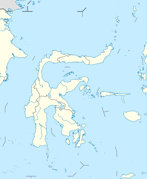
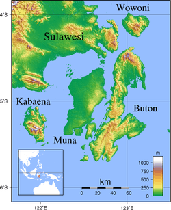
Kabaena or Tokotua is an island in the Flores Sea, Indonesia, off the coast of Sulawesi. Most of it is a part of Bombana Regency within Southeast Sulawesi province, although the southernmost district (Talaga Raya) is administratively part of Central Buton Regency. The island's area is 900.73 km² and its total population at the 2010 Census was 35,558.[1]
 Kabaena | |
| Geography | |
|---|---|
| Location | South East Asia |
| Coordinates | 5°15′S 121°55′E |
| Area | 900.73 km2 (347.77 sq mi) |
| Administration | |
| Province | |
| Demographics | |
| Population | 35,558 (2010 Census) |
| Pop. density | 39.5/km2 (102.3/sq mi) |

Kabaena and surrounding islands of the Buton Archipelago
Districts
| Name | English name | Area in km2 | Population Census 2010 |
|---|---|---|---|
| Kabaena Utara | North Kabaena | 127.78 | 3,671 |
| Kabaena Barat | West Kabaena | 46.77 | 7,492 |
| Kabaena | Kabaena | 103.49 | 2,849 |
| Kabaena Selatan | South Kabaena | 130.10 | 2,606 |
| Kabaena Tengah | Central Kabaena | 276.00 | 3,254 |
| Kabaena Timur | East Kabaena | 122.89 | 6,663 |
| Talaga Raya | 93.70 | 9,023 | |
| (Total of Kabaena Island) | 900.73 | 35,558 |
gollark: What did the bots do? Surely they could be made to just not interact with each other constantly.
gollark: A highlight feature could be helpful.
gollark: I can make *my* bot open bidirectional communication links to any channel I have the ID of (which it's in) but I never needed to do this.
gollark: Well, no idea, I don't have very much information.
gollark: Hmm. That actually sounds reasonable.
References
- Biro Pusat Statistik, Jakarta, 2011.
This article is issued from Wikipedia. The text is licensed under Creative Commons - Attribution - Sharealike. Additional terms may apply for the media files.