K-19 (Kansas highway)
K-19 is a 33.915-mile-long (54.581 km) state highway in the U.S. state of Kansas. From U.S. Route 50 (US-50) to K-19 Spur it is signed as north–south and from K-19 Spur to US-281 it is signed as east–west. K-19's southern terminus is at US-50 in Belpre, and the eastern terminus is at US-281 east of Seward.
| ||||
|---|---|---|---|---|
%26groups%3D_e9ad956bf382f7fe7c498b18bf2d0a8958604a74.svg)
K-19 in red, K-19 Spur in blue | ||||
| Route information | ||||
| Maintained by KDOT | ||||
| Length | 33.915 mi[1] (54.581 km) | |||
| Existed | 1927[2]–present | |||
| Major junctions | ||||
| South end | ||||
| East end | ||||
| Location | ||||
| Counties | Edwards, Pawnee, Stafford | |||
| Highway system | ||||
| ||||

K-19 was first designated in 1927, and at that time started in Belpre and ended in Larned. Then between 1931 and 1932, K-19 was extended east, from south of Larned, along the former K-37 designation to K-8, now US-281.
Route description
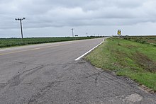
K-19 runs north–south for its first 15.1 miles (24.3 km), and east–west for its final 18.8 miles (30.3 km). The first leg begins at US-50 in Belpre and near the Arkansas River south of Larned, K-19 turns east for its second leg, bypassing both Radium and Seward to the south before ending at US-281.[3][4]
K-19 begins at US-50 in Belpre and shortly crosses an Amtrak track then leaves Belpre. It then continues northward for three miles (4.8 km) through flat rural farmlands before entering into Pawnee County. Approximately four miles (6.4 km) north of the county line it crosses Pickle Creek, a tributary of the Arkansas River, and passes Zook. From there it continues northward for roughly seven miles (11 km) then reaches the terminus of K-19 Spur. At this point it is redesignated as an east–west route. K-19 Spur crosses the Arkansas River and ends about 0.8 miles (1.3 km) later at US-56 in Larned.[3][4][5]
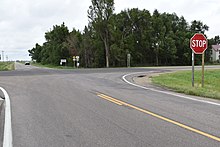
From K-19 Spur, K-19 travels eastward for about 5.5 miles (8.9 km) before crossing Pickle Creek again. From there it continues eastward for roughly another 4.5 miles (7.2 km) and crosses into Stafford County, traveling south of Radium 1 mile (1.6 km) after crossing the county line. After roughly another 5.5 miles (8.9 km) it reaches the terminus of the former K-219, a .995-mile-long (1.601 km) spur that served Seward until it was decommissioned in 2013.[6] It then continues another 2.5 miles (4.0 km) and reaches its eastern terminus at US-281.[3][4][5]
The Kansas Department of Transportation (KDOT) tracks the traffic levels on its highways, and in 2017, they determined that on average the traffic varied from 540 vehicles at the terminus of former K-219 to 1390 vehicles slightly south of the terminus of K-19 Spur.[7] K-19 is not included in the National Highway System.[8] The National Highway System is a system of highways important to the nation's defense, economy, and mobility. K-19 does connect to the National Highway System at each terminus, US-50 and US-281, as well as to US-56 via K-19 Spur.[9]
History
K-19 was first designated by KDOT in 1927, and at that time ran from US-50S in Belpre northward to US-50N in Larned. Also at that time the segment from K-19 Spur eastward to then K-8 was designated as K-37.[2] Between 1931 and 1932, the K-37 designation was removed and K-19 was extended along its old alignment to K-8 which later became US-281.[10][11] In 1956, K-19 was extended .4 miles (640 m) southward in Edwards County when US-50, at the time US-50S, was slightly realigned within Belpre.[12][13][3] In Pawnee County, K-19 was slightly realigned just south of K-19 Spur to eliminate some sharp curves.[14][4]
In Stafford County, K-19 originally turned north on present day Radium Road towards Radium, then followed NW 150th Street east to end at US-281, passing just to the south of Seward along the way.[15] In a September 25, 1946 resolution, the turn to the north at Radium Road was eliminated and K-19 was realigned to continue eastward to its current eastern terminus.[16][17]
Major junctions
| County | Location | mi[1] | km | Destinations | Notes |
|---|---|---|---|---|---|
| Edwards | Belpre | 0.000 | 0.000 | Southern terminus | |
| Pawnee | Pleasant Grove Township | 15.142 | 24.369 | Southern terminus of K-19 Spur; K-19 changes from south–north to west–east | |
| Stafford | South Seward Township | 33.915 | 54.581 | Eastern terminus | |
| 1.000 mi = 1.609 km; 1.000 km = 0.621 mi | |||||
Spur route
| |
|---|---|
| Location | Larned |
| Length | 0.800 mi (1.287 km) |
| Existed | c. 1932–present |
K-19 Spur is a 0.8-mile-long (1.3 km) spur route of K-19. K-19 Spur begins at an intersection with K-19, just south of where it crosses the Arkansas River, and travels northward to US-56 in Larned. 2017 AADT on K-19 Spur was 2650.[7][4]
Major junctions
The entire route is in Pawnee County.
| Location | mi[1] | km | Destinations | Notes | |
|---|---|---|---|---|---|
| Pleasant Grove Township | 0.000 | 0.000 | Southern terminus | ||
| Larned | 0.800 | 1.287 | Northern terminus | ||
| 1.000 mi = 1.609 km; 1.000 km = 0.621 mi | |||||
References
- Kansas Department of Transportation (2016). "Pavement Management Information System". Kansas Department of Transportation. Retrieved April 15, 2017.
- Rand McNally and Company (1927). "Kansas" (Map). Rand McNally Auto Road Atlas of the United States and Ontario, Quebec, and the Maritime Provinces of Canada, with a Brief Description of the National Parks and Monuments. 1:1,600,000. Chicago: Rand McNally and Company. pp. 54–55. OCLC 2078375 – via Rumsey Collection.
- Bureau of Transportation Planning (2011). Edwards County (PDF) (Map). [c. 1:211,200]. General Highway Map. Topeka: Kansas Department of Transportation. Retrieved August 2, 2019.
- Bureau of Transportation Planning (October 2010). Pawnee County (PDF) (Map). [c. 1: 211,200]. General Highway Map. Topeka: Kansas Department of Transportation. Retrieved August 2, 2019.
- Google (December 29, 2015). "Overview of K-19" (Map). Google Maps. Google. Retrieved December 29, 2015.
- Bureau of Transportation Planning (April 15, 2013). "State Highway Resolution for Highway K-219". Topeka: Kansas Department of Transportation. Retrieved August 2, 2019.
- Bureau of Transportation Planning (2018). Traffic Flow Map Kansas State Highway System (PDF) (Map). [c. 1:1,584,000]. Topeka: Kansas Department of Transportation. Retrieved July 29, 2019.
- Federal Highway Administration (May 8, 2019). National Highway System: Kansas (PDF) (Map). [c. 1:3,900,000]. Federal Highway Administration. Retrieved July 29, 2019.
- Natzke, Stefan; Neathery, Mike; Adderly, Kevin (September 26, 2012). "What is the National Highway System?". National Highway System. Federal Highway Administration. Retrieved July 29, 2019.
- Rand McNally and Company (1931). "Kansas" (Map). Clason's Road Map of Kansas. 1:2,000,000. Denver: Clason Map Company. p. 87 – via Rumsey Collection.
- State Highway Commission of Kansas (1932). Kansas State Highway System (PDF) (Map). Scale not given. Topeka: State Highway Commission of Kansas. OCLC 1007837202. Retrieved August 2, 2019.
- State Highway Commission of Kansas (January 27, 1956). "Resolution for Relocation and Redesignation of Road in Edwards County". Topeka: State Highway Commission of Kansas. Retrieved August 2, 2019.
- Kansas State Highway Department (1940). Edwards County (PDF) (Map). Scale not given. Highway & Transportation Map. Topeka: Kansas State Highway Department. Retrieved August 2, 2019.
- Kansas State Highway Department (1940). Pawnee County (PDF) (Map). Scale not given. Highway & Transportation Map. Topeka: Kansas State Highway Department. Retrieved August 2, 2019.
- Kansas State Highway Department (1941). Stafford County (PDF) (Map). Scale not given. Highway & Transportation Map. Topeka: Kansas State Highway Department. Retrieved August 2, 2019.
- State Highway Commission of Kansas (September 25, 1946). "Resolution for Relocation and Redesignation of Road in Stafford County". Topeka: State Highway Commission of Kansas. Retrieved August 2, 2019.
- Highway Planning Department (1955). Stafford County (PDF) (Map). Scale not given. General Highway Map. Topeka: State Highway Commission of Kansas. Retrieved August 2, 2019.