Jefferson City Memorial Airport
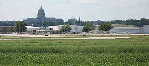
Jefferson City Memorial Airport (IATA: JEF, ICAO: KJEF, FAA LID: JEF) is two miles (3 km) northeast of Jefferson City, in Callaway County, Missouri. It is owned by the City of Jefferson City.[1]
Jefferson City Memorial Airport | |||||||||||||||
|---|---|---|---|---|---|---|---|---|---|---|---|---|---|---|---|
| Summary | |||||||||||||||
| Airport type | Public | ||||||||||||||
| Owner | City of Jefferson City | ||||||||||||||
| Location | Jefferson City, Missouri | ||||||||||||||
| Elevation AMSL | 549 ft / 167 m | ||||||||||||||
| Coordinates | 38°35′28″N 092°09′22″W | ||||||||||||||
| Website | http://www.jeffersoncitymo.gov/government/airport.php | ||||||||||||||
| Runways | |||||||||||||||
| |||||||||||||||
| Statistics | |||||||||||||||
| |||||||||||||||
Ozark DC-3s and M404s stopped there from 1954 until Columbia Regional Airport opened in 1968.
Facilities
The airport covers 469 acres (190 ha) and has two paved runways: 12/30 is 6,000 x 100 ft (1,829 x 30 m) and 9/27 is 3,401 x 75 ft (1,037 x 23 m).[1]
In the year ending June 30, 2004 the airport had 34,402 aircraft operations, an average of 94 per day: 83% general aviation, 15% military and 2% air taxi. In January 2020, there were 60 aircraft based at this airport: 28 single-engine, 13 multi-engine, 9 jet, 3 helicopters and 7 military.[1]
Accidents
On October 14, 2004 Pinnacle Airlines Flight 3701 crashed short of Jefferson City Memorial Airport; both persons on board were killed.
References
- FAA Airport Master Record for JEF (Form 5010 PDF), effective January 2, 2020
External links
- Resources for this airport:
- FAA airport information for JEF
- AirNav airport information for KJEF
- ASN accident history for JEF
- FlightAware airport information and live flight tracker
- NOAA/NWS weather observations: current, past three days
- SkyVector aeronautical chart, Terminal Procedures