Jeansagnière
Jeansagnière is a former commune in the Loire department in central France. On 1 January 2016, it was merged into the new commune Chalmazel-Jeansagnière.[2]
Jeansagnière | |
|---|---|
Part of Chalmazel-Jeansagnière | |
 | |
Location of Jeansagnière 
| |
 Jeansagnière  Jeansagnière | |
| Coordinates: 45°44′02″N 3°50′12″E | |
| Country | France |
| Region | Auvergne-Rhône-Alpes |
| Department | Loire |
| Arrondissement | Montbrison |
| Canton | Boën-sur-Lignon |
| Commune | Chalmazel-Jeansagnière |
| Area 1 | 14.01 km2 (5.41 sq mi) |
| Population (2017)[1] | 95 |
| • Density | 6.8/km2 (18/sq mi) |
| Time zone | UTC+01:00 (CET) |
| • Summer (DST) | UTC+02:00 (CEST) |
| Postal code | 42920 |
| Elevation | 900–1,383 m (2,953–4,537 ft) (avg. 1,100 m or 3,600 ft) |
| 1 French Land Register data, which excludes lakes, ponds, glaciers > 1 km2 (0.386 sq mi or 247 acres) and river estuaries. | |
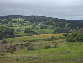
Geography
The river Lignon du Forez formed all of the commune's southern border.
gollark: Don't try running Siri. It won't end well.
gollark: Also, it blocks unsafe programs, such as "Webicity" and "Siri".
gollark: You can also use the `viewsource` command to view the source of internal functions e.g. `viewsource fs.open`.
gollark: Yes, it's hard to get around that.
gollark: Yes.
See also
References
- Téléchargement du fichier d'ensemble des populations légales en 2017, INSEE
- Arrêté préfectoral 22 October 2015 (in French)
| Wikimedia Commons has media related to Jeansagnière. |
| Authority control |
|
|---|
This article is issued from Wikipedia. The text is licensed under Creative Commons - Attribution - Sharealike. Additional terms may apply for the media files.