Javorani
Javorani (Cyrillic: Јаворани), is a village in Kneževo (Skender Vakuf) municipality, near Banja Luka, Republika Srpska, Bosnia and Herzegovina.
Javorani | |
|---|---|
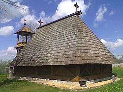 Old St. Nicholas Church in Javorani. | |
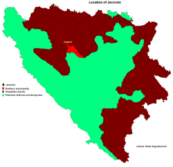 Location of Javorani in Bosnia and Herzegovina | |
| Coordinates: 44°37′N 17°15′E | |
| Country | Bosnia and Herzegovina |
| Division | Republika Srpska |
| Municipality | Kneževo |
| Government | |
| • Local community president | Brane Tubić (SNSD) |
| Area | |
| • Total | 25 km2 (10 sq mi) |
| Population (1991) | |
| • Total | 1,289 |
| Time zone | UTC+2 (EET) |
| • Summer (DST) | UTC+3 (EEST) |
| Postal code | 78233 |
| Area code(s) | (+387) 51 |
History
Until 1955, Javorani belonged to the former Previle Municipality, Kotor Varoš.
Population
Ethnic composition, 1991 census
| Ethnic composition of Skender Vakuf municipality, by settlements, 1991. census | ||||||
| settlement | total | Serbs | Croats | Muslims | Yugoslavs | others |
| Javorani | 1,289 | 1,273 | 1 | 0 | 6 | 9 |
gollark: ***also, maybe use potatOS or something***
gollark: ***release it***
gollark: You should, then.
gollark: But people like ore3d more.
gollark: I mean, squid made a cooler 3D version using new plethora stuff.
References
- Official results from the book: Ethnic composition of Bosnia-Herzegovina population, by municipalities and settlements, 1991. census, Zavod za statistiku Bosne i Hercegovine - Bilten no.234, Sarajevo 1991.
Gallery
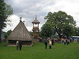 Old St. Nicholas Church from 1757.
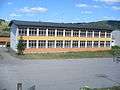 New Primary school in Javorani.
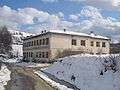 Old Primary school in Javorani.
.jpg) Mountain Tisovac.
Mountain Tisovac.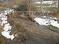 River Kotlovac.
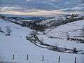 Winter in Javorani.
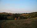 Landscape in Javorani.
People from Javorani
- Lazar Tešanović - One of the Chetniks leader in Bosnia during World War II.
See also
- Old St. Nicholas Church, Javorani
This article is issued from Wikipedia. The text is licensed under Creative Commons - Attribution - Sharealike. Additional terms may apply for the media files.