Jakapur Dam
Jakapur Dam, is an earthfill dam on local river near Umarga, Osmanabad district in state of Maharashtra in India.
| Jakapur Dam | |
|---|---|
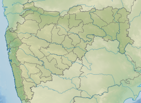 Location of Jakapur Dam in Maharashtra | |
| Official name | Jakapur Dam D01319 |
| Location | Umarga |
| Coordinates | 17.8382056°N 76.5671003°E |
| Opening date | 1977[1] |
| Owner(s) | Government of Maharashtra, India |
| Dam and spillways | |
| Type of dam | Earthfill |
| Impounds | local river |
| Height | 14.8 m (49 ft) |
| Length | 2,257 m (7,405 ft) |
| Dam volume | 322 km3 (77 cu mi) |
| Reservoir | |
| Total capacity | 0 km3 (0 cu mi) |
| Surface area | 0 km2 (0 sq mi) |
Specifications
The height of the dam above lowest foundation is 14.8 m (49 ft) while the length is 2,257 m (7,405 ft). The volume content is 322 km3 (77 cu mi) and gross storage capacity is 10,176.00 km3 (2,441.35 cu mi).[2]
Purpose
- Irrigation
gollark: No.
gollark: I really need some way to make the Soviet national anthem come out less... garbled.
gollark: The main difference between real electricity and RF is just RF can be much more conveniently stored. Everything has nice buffers in it.
gollark: You can conveniently accumulate it in machine buffers, there are no voltages or AC vs DC or direction or resistance/impedance to worry about, no weird electromagnetic things going on, machines will just run at lower speed if you're lacking power (I experienced this while running my entire machine setup off a cheap 5RF/t solar panel on kukipack).
gollark: It's meant to be energy, but it *works* as if it's basically just a fluid.
See also
- Dams in Maharashtra
- List of reservoirs and dams in India
References
- "Jakapur D01319". Archived from the original on 12 April 2013. Retrieved 6 March 2013.
- Specifications of large dams in India Archived 21 July 2011 at the Wayback Machine
This article is issued from Wikipedia. The text is licensed under Creative Commons - Attribution - Sharealike. Additional terms may apply for the media files.