Iremel
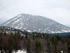
Iremel (Bashkir: Ирәмәл, Russian: Иремель) is a compact mountain ridge in the Southern Ural Mountains in the republic of Bashkortostan, Russian Federation (bordering with Chelyabinsk Oblast to the north-west). The highest peak, Bolshoy Iremel (Big Iremel), or simply Iremel, stands at 1589 metres (5200 ft) high. Maly Iremel (Small Iremel), 6 kilometers north-east, stands at 1449 meters. It is the source of the River Belaya.[1][2]
| Mount Iremel | |
|---|---|
 | |
| Highest point | |
| Elevation | 1,589 m (5,213 ft) |
| Coordinates | 54°30′54″N 58°50′24″E |
| Geography | |
| Location | Republic of Bashkortostan, Russia |
| Parent range | Ural Mountains |
The highest peak of the South Urals, Mount Yamantaw (1638 meters) is located 53 kilometers south-west from Bolshoy Iremel.
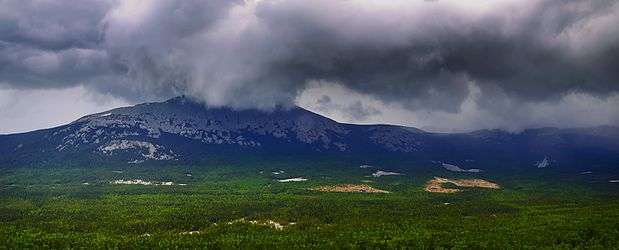
Gallery
gollark: Were you likely to escape battery explosions with non-bulletproof glass?
gollark: There are non-tesla electric vehicle companies at least.
gollark: And their vehicles can be remotely firmware-updated and such.
gollark: Tesla have some sort of awful part lock-in thing going on.
gollark: As far as I can tell, yes, random webpages agree that fossil fuel plants are 35%ish efficient mostly.
References
This article is issued from Wikipedia. The text is licensed under Creative Commons - Attribution - Sharealike. Additional terms may apply for the media files.