Iperó
Iperó is a municipality in the state of São Paulo in Brazil. It is part of the Metropolitan Region of Sorocaba.[1] The population is 33,367 (2015 est.) in an area of 170.29 km².[2] The elevation is 590 m. The Sorocaba River flows near Iperó. Iperó is accessed with the highway SP-280.
Iperó | |
|---|---|
 Flag  Coat of arms | |
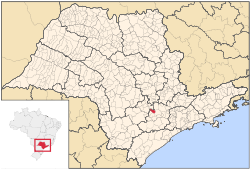 Location in São Paulo state | |
 Iperó Location in Brazil | |
| Coordinates: 23°21′1″S 47°41′19″W | |
| Country | Brazil |
| Region | Southeast |
| State | São Paulo |
| Metrop. region | Sorocaba |
| Area | |
| • Total | 170.29 km2 (65.75 sq mi) |
| Elevation | 590 m (1,940 ft) |
| Population (2018) | |
| • Total | 36,280 |
| • Density | 210/km2 (550/sq mi) |
| Time zone | UTC-03:00 (BRT) |
| • Summer (DST) | UTC-02:00 (BRST) |
| Postal code | 18560 |
| Area code | +55 15 |
| Website | www |
Population history
| Year | Pop. | ±% |
|---|---|---|
| 2001 | 18,384 | — |
| 2007 | 24,239 | +31.8% |
| 2015 | 33,367 | +37.7% |
Demographics
According to the 2000 IBGE Census, the population was 18,384, of which 12,649 are urban and 5,735 are rural. The average life expectancy was 72.42 years. The literacy rate was 91.8%.
gollark: It also has a frontend for the Linux fortune command.
gollark: And my bot. It has useful features like arbitrary code execution and reminders.
gollark: Actually, you probably could check if it's green or not as a reasonable heuristic.
gollark: It's not like detecting if something isn't a plant is trivial either.
gollark: But… why?
References
- "Governo do Estado de São Paulo, Lei Complementar nº 1.241, de 8 de maio de 2014". Archived from the original on 18 October 2014. Retrieved 2015-09-29.
- Instituto Brasileiro de Geografia e Estatística
External links
- (in Portuguese) http://www.ipero.sp.gov.br
- (in Portuguese) Iperó on citybrazil.com.br
This article is issued from Wikipedia. The text is licensed under Creative Commons - Attribution - Sharealike. Additional terms may apply for the media files.