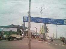
Inner Ring Road, Guntur
The Inner Ring Road (officially: Mahatma Gandhi Inner Ring Road) is a Freeway of Guntur in the Indian state of Andhra Pradesh. It stretches to 6.34 km (3.94 mi) in length and was laid at a cost of ![]()
| Inner Ring Road, Guntur | |
|---|---|
| Route information | |
| Maintained by Guntur Municipal Corporation, APCRDA | |
| Length | 6.34 km (3.94 mi) |
| Highway system | |
| |

Mahatma Gandhi Inner Ring Road, Guntur
Route
The route of the road starts at Autonagar area of the city at National Highway 5 and ends after encircling the city at Ankireddypalem on the same National Highway. The areas which it covers in the stretch are, Agathavarappadu, Gorantla, JKC college Road, Peda Palakaluru, Turakapalem, Nallapadu.[2][3]
gollark: This round I decided to make my guesses with science, so I just plugged all the past rounds into stylometry.
gollark: What an excellent way to pick guesses!
gollark: Just infer who wrote each entry and put it down.
gollark: Nobody calls it ajax any more.
gollark: Randomly? Deterministically?
References
- "AP CM inaugurates phase I & II of Guntur inner ring road". Business Standard. Hyderabad. 16 February 2014. Retrieved 3 March 2016.
- "Guntur Inner Ring Road Inaugurated by Kiran". The New Indian Express. 17 February 2014. Retrieved 3 March 2016.
- "VUDA gives nod for phase 3, 4 of IRR". The Hindu. 10 November 2013. ISSN 0971-751X. Retrieved 17 May 2016.
This article is issued from Wikipedia. The text is licensed under Creative Commons - Attribution - Sharealike. Additional terms may apply for the media files.