Hua Taphan District
Hua Taphan (Thai: หัวตะพาน, pronounced [hǔa̯ tā.pʰāːn]) is a district (amphoe) of Amnat Charoen Province, northeastern Thailand.
Hua Taphan หัวตะพาน | |
|---|---|
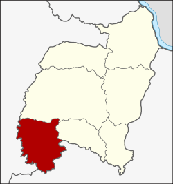 District location in Amnat Charoen Province | |
| Coordinates: 15°41′48″N 104°29′30″E | |
| Country | Thailand |
| Province | Amnat Charoen |
| Seat | Rattanawari |
| Area | |
| • Total | 533.0 km2 (205.8 sq mi) |
| Population (2005) | |
| • Total | 50,524 |
| • Density | 94.8/km2 (246/sq mi) |
| Time zone | UTC+7 (ICT) |
| Postal code | 37240 |
| Geocode | 3706 |
History
The minor district (king amphoe) was established on 15 August 1967, when four tambons: Hua Taphan, Kham Phra, Nong Kaeo, and Kheng Yai were split off from Mueang Amnat Charoen District.[1] It was upgraded to a full district on 17 November 1971.[2] In 1993 it was one of the districts which formed the new province, Amnat Charoen.[3]
Geography
Neighboring districts are (from the north clockwise): Mueang Amnat Charoen and Lue Amnat of Amnat Charoen Province; Muang Sam Sip and Khueang Nai of Ubon Ratchathani Province; and Kham Khuean Kaeo and Pa Tio of Yasothon Province.
Administration
The district is divided into eight sub-districts (tambons), which are further subdivided into 85 villages (mubans). Hua Taphan is a township (thesaban tambon) which covers parts of tambons Hua Taphan, Nong Kaeo, and Rattanawari. There are a further seven tambon administrative organizations (TAO).
| No. | Name | Thai name | Villages | Pop. | |
|---|---|---|---|---|---|
| 1. | Hua Taphan | หัวตะพาน | 9 | 6,220 | |
| 2. | Kham Phra | คำพระ | 12 | 6,882 | |
| 3. | Kheng Yai | เค็งใหญ่ | 10 | 6,186 | |
| 4. | Nong Kaeo | หนองแก้ว | 10 | 4,396 | |
| 5. | Phon Mueang Noi | โพนเมืองน้อย | 12 | 7,086 | |
| 6. | Sang Tho Noi | สร้างถ่อน้อย | 13 | 8,111 | |
| 7. | Chik Du | จิกดู่ | 12 | 7,019 | |
| 8. | Rattanawari | รัตนวารี | 7 | 4,624 |
References
- ประกาศกระทรวงมหาดไทย เรื่อง แบ่งท้องที่ตั้งเป็นกิ่งอำเภอ: แบ่งท้องที่อำเภออำนาจเจริญ ตั้งเป็น กิ่งอำเภอหัวตะพาน (PDF). Royal Gazette (in Thai). 84 (80 ง): 2396. August 29, 1967.
- พระราชกฤษฎีกาตั้งอำเภอปลาปาก อำเภอเชียงกลาง อำเภอปากชม อำเภอบ้านม่วง อำเภอพังโคน อำเภอดอนสัก อำเภอพนม อำเภอเวียงสระ อำเภอสังคม และอำเภอหัวตะพาน พ.ศ. ๒๕๑๔ (PDF). Royal Gazette (in Thai). 88 (123 ก): 745–748. November 16, 1971.
- "Office of the Non-Formal Education Commission". Archived from the original on 2007-09-27. Retrieved 2007-03-29.