Hohensaaten
Hohensaaten is a village and a former municipality in Brandenburg in Germany. Since 1 January 2009, it is part of the municipality Bad Freienwalde.
Hohensaaten | |
|---|---|
Stadtteil of Bad Freienwalde | |
Location of Hohensaaten 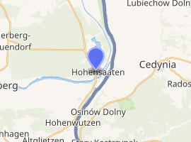
| |
 Hohensaaten  Hohensaaten | |
| Coordinates: 52°52′N 14°09′E | |
| Country | Germany |
| State | Brandenburg |
| District | Märkisch-Oderland |
| Town | Bad Freienwalde |
| Area | |
| • Total | 21.90 km2 (8.46 sq mi) |
| Elevation | 2 m (7 ft) |
| Population (2006-12-31) | |
| • Total | 784 |
| • Density | 36/km2 (93/sq mi) |
| Time zone | CET/CEST (UTC+1/+2) |
| Postal codes | 16248 |
| Dialling codes | 033368 |
| Website | www.hohensaaten.de |
History
Hohensaaten was first mentioned in 1258. The village belonged to Barnim district. After a year-long dispute between municipal board and citizens, partly because of averse to the Barnim district, the treaty of mergence with city of Bad Freienwalde was signed on 14 November 2008.[1] Since 1 January 2009, it is part of the municipality Bad Freienwalde, hence part of Märkisch-Oderland district.[2]
gollark: That actually makes sense.
gollark: Gibson is trying to make it look like it's *excessively obviously* Gibson to deflect suspicion from Gibson, also.
gollark: He hackerized the Discord mainframe.
gollark: Ææa?
gollark: But what if gibson was orchestrating the leaks to try and imply that it wasn't him by making the timing suspicious so that it looked like someone trying to show it was him?
This article is issued from Wikipedia. The text is licensed under Creative Commons - Attribution - Sharealike. Additional terms may apply for the media files.