Hodal
Hodal is a city and a municipal council in Palwal district in the Haryana state of India. It is located at 27°53′39″N 77°22′09″E and has an average elevation of 190 meters (620 feet).
Hodal | |
|---|---|
city | |
| Hodal City | |
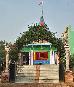
 Lord HanumanTemple at Chameli Van dham | |
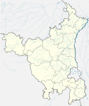
 Hodal Location in Haryana, India  Hodal Hodal (India) | |
| Coordinates: 27.894°N 77.369°E | |
| Country | |
| State | Haryana |
| District | Palwal |
| Elevation | 190 m (620 ft) |
| Population (2011) | |
| • Total | 72,450 |
| • Rank | 2nd |
| Languages | |
| • Official | Hindi |
| Time zone | UTC+5:30 (IST) |
| PIN | 121106 |
| ISO 3166 code | IN-HR |
| Vehicle registration | HR50 .... |
| Website | haryana |
Hodal is a Haryana Legislative Assembly constituency segment, within the Faridabad Lok Sabha constituency.[1]
Temples
Here are some of the temples from Hodal City.[2]
- Panduwan Mandir
- Shree Tyagi Bawa Mandir
- Chameliwan Mandir
- Pathwari Mandir
- Lakshami Narayan Mandir
- Shree Sati Mandir
Demographics
As of the 2001 India census,[3] Hodal had a population of 55,306. Males constituted 53% of the population and females 47%. Hodal has an average literacy rate of 57%, lower than the national average of 59.5%: male literacy is 67%, and female literacy is 46%. In Hodal, 18% of the population is under 6 years of age.
Nearby towns
- Banchari
- Aurangabad
gollark: That seems like a bizarre argument.
gollark: The computer systems use last names for login, though.
gollark: I pick all my crimes via unbiased RNG.
gollark: It's america, so yes.
gollark: On a slightly related note, osmarks.net data harvesting.
References
- "Parliamentary/Assembly Constituency wise Electors in Final Roll 2009" (PDF). Chief Electoral Officer, Haryana. Archived from the original (PDF) on 9 April 2009.
- "गोमाता का पूजन कर निकाली प्रभात फेरी". m.jagran.com (in Hindi). Retrieved 25 August 2019.
- "Census of India 2001: Data from the 2011 Census, including cities, villages and towns (Provisional)". Census Commission of India. Archived from the original on 16 June 2004. Retrieved 1 November 2008.
External links
| Wikimedia Commons has media related to Hodal. |
This article is issued from Wikipedia. The text is licensed under Creative Commons - Attribution - Sharealike. Additional terms may apply for the media files.
