Historic and Architectural Resources of Route 66 Through Illinois
U.S. Route 66 was a highway established on November 11, 1926, connecting Chicago, Illinois to the Southwest. Several buildings from the Route 66 era still stand and are part of the Historic and Architectural Resources of Route 66 Through Illinois Multiple Property Submission on the National Register of Historic Places.
| Resource Name | Image | Address | City | Added |
| Ambler's Texaco Gas Station | 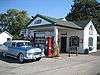 | Illinois Route 17 and Old U.S. 66 41°5′39″N 88°26′26″W | Dwight | November 29, 2001 |
| Ariston Café | 314 Old Route 66 39°10′38″N 89°40′5″W | Litchfield | May 5, 2006 | |
| Alternate Route 66, Wilmington to Joliet | 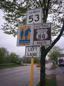 | Illinois Route 53 between Wilmington and Joliet 41°24′16″N 88°6′27″W | Joliet and Wilmington | May 5, 2006 |
| Belvidere Café, Motel, and Gas Station | 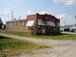 | 817 Old Route 66 39°10′16″N 89°40′3″W | Litchfield | February 21, 2007 |
| Chain of Rocks Bridge | West Chain of Rocks Rd. 38°45′41″N 90°10′26″W | Madison | December 01, 2006 | |
| Dell Rhea's Chicken Basket | 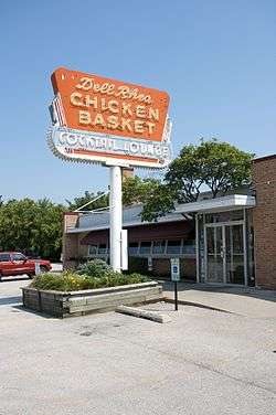 | 645 Joliet Road 41°44′51″N 87°56′22″W | Willowbrook | May 5, 2006 |
| Lou Mitchell's Restaurant | 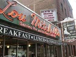 | 565 W. Jackson Blvd. 41°52′38″N 87°38′30″W | Chicago | May 5, 2006 |
| Route 66 by Carpenter Park | Old Route 66 between Cabin Smoke Trail and north bank of the Sangamon River 39°52′21″N 89°36′51″W | Springfield and Sherman | May 9, 2002 | |
| Route 66, Cayuga to Chenoa |  | Route 66, between just N. of Township Rd 2200 N. and just S. of Township Rd 3000 N. 40°45′12″N 88°43′7″W | Pontiac | July 23, 2003 |
| Route 66, Girard to Nilwood | Route 66, between Illinois Route 4 (IL 4) south of Girard and IL 4 in Nilwood 39°24′45″N 89°47′16″W | Nilwood | May 23, 2002 | |
| Route 66, Litchfield to Mount Olive | 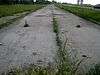 | Route 66, N of Illinois Route 16 in Litchfield to Mount Olive 39°7′48″N 89°41′34″W | Litchfield | November 29, 2001 |
| Route 66 South of Lake Springfield | Olde Rt. 66/Olde Carriage Way 39°40′30.9″N 89°37′28.92″W | Springfield | May 12, 2009 | |
| Sprague's Super Service | 305 E. Pine St. 40°31′3″N 88°58′51″W | Normal | April 25, 2008 | |
| Standard Oil Gasoline Station | 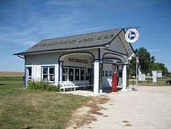 | 400 S. West St. 41°0′7″N 88°31′44″W | Odell | November 9, 1997 |
| Soulsby Service Station | 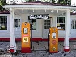 | 102 S. Route 66 St. 39°4′23″N 89°44′8″W | Mount Olive | May 06, 2004 |
Route 66 Through Illinois Multiple Property Submission | |
 | |
| Location | Illinois, US |
|---|---|
| NRHP reference No. | 64500208 |
| Added to NRHP | May 5, 2006 |
This article is issued from Wikipedia. The text is licensed under Creative Commons - Attribution - Sharealike. Additional terms may apply for the media files.