Hilo District, Hawaii
Hilo is a moku or district on the Big Island of Hawaiʻi in the State of Hawaii, U.S.A. In the current system of administration of Hawaiʻi County, the moku of Hilo is divided into North Hilo District (Hilo ‘Akau) and South Hilo District (Hilo Hema).
Hilo is located on the eastern, leeward side of the island, enjoying abundance of rainfall, and therefore includes the island's most populated town, also called Hilo. [1]
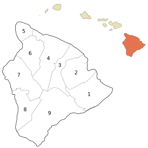
(3) North Hilo and (2) South Hilo Districts are located in the east coast of Hawaii County (the Big Island). They are bordered by Hamakua District (4) in the north, and by Kau District (9) in the south and Puna District (1) in the southeast. The far inland areas are largely unpopulated, being forest reserves on the slopes of Mauna Kea and Mauna Loa.
Gallery
 Rainbow Falls, Hawaii
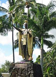 Kamehameha Statue in Hilo
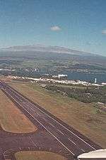 Hilo International Airport, with Mauna Kea in the back
.jpg) Puu Huluhulu as seen from the Mauna Kea road
Puu Huluhulu as seen from the Mauna Kea road
gollark: What are you meant to do, just go "hmm, yes, let's just hope it all works out magically".
gollark: You can totally somewhat advance plan political stuff.
gollark: I mean, they centrally plan some stuff, but the majority of resource allocation is marketized.
gollark: Not really.
gollark: 𝐈 𝐀𝐌 𝐁𝐄𝐈𝐍𝐆 𝐑𝐄𝐒𝐏𝐄𝐂𝐓𝐅𝐔𝐋, 𝐋𝐘𝐑𝐈𝐂𝐋𝐘. 𝐘𝐎𝐔 𝐀𝐑𝐄 𝐖𝐑𝐎𝐍𝐆.
References
- James A. Bier, Cartographer, Map of Hawai'i, the Big Island, Eighth Edition (University of Hawai'i Press)
- Laupāhoehoe Train Museum
- King Kuhio Shopping Center
- Puanako Center
External links
Islands, municipalities, and communities of Hawaii County, Hawaii, United States | ||
|---|---|---|
| CDPs |
| 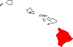 Map of Hawaii highlighting Hawaii County |
| Unincorporated communities | ||
| Districts | ||
This article is issued from Wikipedia. The text is licensed under Creative Commons - Attribution - Sharealike. Additional terms may apply for the media files.