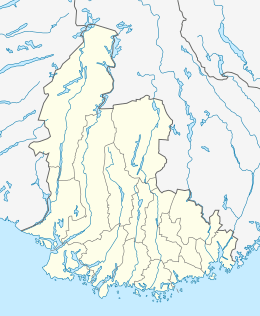
Hellemyrtoppen
Hellemyrtoppen is a neighbourhood in the city of Kristiansand in Vest-Agder county, Norway. It is located in the borough of Grim and in the district of Hellemyr. Hellemyrtoppen is located just north of the European route E39 highway. It is north of Rige, east of Vestheiene, and west of Fjellro.[2]
Hellemyrtoppen | |
|---|---|
Neighborhood in Kristiansand | |
 Hellemyrtoppen Location of the neighborhood  Hellemyrtoppen Hellemyrtoppen (Norway) | |
| Coordinates: 58.1439°N 07.9396°E | |
| Country | Norway |
| County | Vest-Agder |
| Municipality | Kristiansand |
| Borough | Grim |
| District | Hellemyr |
| Elevation | 117 m (384 ft) |
| Time zone | UTC+01:00 (CET) |
| • Summer (DST) | UTC+02:00 (CEST) |
| Postal code | 4628 |
| Area code | 38 |
Transportation
| Road | Stretch |
|---|---|
| E39 | Hannevika - Stavanger |
| Line | Destinations |
|---|---|
| 17 | Hellemyr - Tømmerstø |
| 17 | Hellemyr - Tømmerstø-Frikstad |
| 17 | Hellemyr - Kvadraturen |
| 18 | Hellemyr - Tømmerstø Odderhei-Holte |
| 18 | Hellemyr - Dvergsnes |
| N16 | Hellemyr - Tinnheia - Kvadraturen |
gollark: In any case, an ADT would be better - see Rust's `Result<T>`.
gollark: Destructuring is a wonderful thing.
gollark: ```go(member, err) = session.GuildMember(guildID, userID)// whatever```
gollark: You mean multiple return values, right, and not ADTs?
gollark: You have "product" (two things bundled together) and "sum" (two options for a thing).
References
- "Hellemyrtoppen, Kristiansand (Vest-Agder)". yr.no. Retrieved 2017-03-04.
- "Kristiansand kommune - Start". www.kristiansand.kommune.no. Retrieved 2015-10-10.
- "Informasjon om veg og trafikk". www.vegvesen.no. Statens vegvesen. Retrieved 2015-10-10.
- "Hjem / Agder Kollektivtrafikk". www.akt.no. Retrieved 2015-10-10.
This article is issued from Wikipedia. The text is licensed under Creative Commons - Attribution - Sharealike. Additional terms may apply for the media files.