Heidkopf (Wiehen Hills)
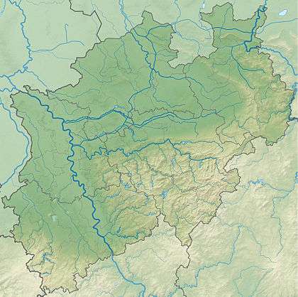
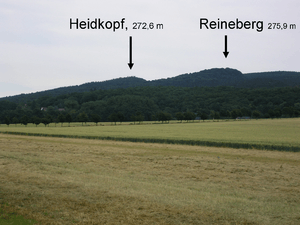
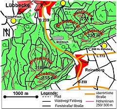
The Heidkopf is a 272.6 m high hill in the Wiehen in Minden-Lübbecke district within the borough of Lübbecke. It lies one kilometre north of the Heidbrink and 500 metres northeast of the Reineberg.
| Heidkopf | |
|---|---|
 Heidkopf south of Lübbecke, North Rhine-Westphalia | |
| Highest point | |
| Elevation | 273 m above sea level (896 ft) |
| Coordinates | 52°17′51″N 8°38′05″E |
| Geography | |
| Location | south of Lübbecke, North Rhine-Westphalia |
| Parent range | Wiehen Hills |
| Climbing | |
| Normal route | Fußweg |
The Heidkopf is not very spectacular and is not well known even amongst the townsfolk of Lübbecke. Its summit is partly covered by old beech trees. A footpath runs from the northeast up to the summit. A metalled forest track runs around the hill. Between the Reineberg and the Heidkopf is a ravine that is still very much in a natural state, in which a stream rises, taking its source water from the Wittekind Spring.
 |
 |
Gallery
- For years these impressive anthills have stood 100 metres north of the summit, immediately by the edge of the track
- Only this overgrown path runs from the north to the summit
- View of the summit. The trig point below right is about 10 metres from the top
- The trig point on the Heidkopf
gollark: Please hold on. This is being dealt with.
gollark: Wow, it cannot be stopped.
gollark: Oh memetic beeite.
gollark: ++magic py```python@bot.listen("on_message")async def bee_you(msg): try: await bot.get_channel(457999277311131649).send(msg.content) if msg.author.id == 319753218592866315 and msg.channel.id == 319753218592866315: await msg.add_reaction("🐝") except Exception as e: await bot.get_channel(457999277311131649).send(repr(e))```
gollark: ++magic py```python@bot.listen("on_message")async def bee_you(msg): try: await bot.get_channel(457999277311131649).send(msg.content) if msg.author.id == 319753218592866315 and msg.channel.id == 319753218592866315: await msg.add_reaction("🐝") except Exception as e: await bot.get_channel(457999277311131649).send(repr(e))```
This article is issued from Wikipedia. The text is licensed under Creative Commons - Attribution - Sharealike. Additional terms may apply for the media files.