Hawaii Route 37
Hawaii Route 37 is a 24.1-mile (38.79 km) road on the island of Maui in Maui County, Hawaii, United States.
| ||||
|---|---|---|---|---|
| Route information | ||||
| Maintained by HDOT | ||||
| Length | 24.1 mi[1] (38.8 km) | |||
| Major junctions | ||||
| South end | ||||
| North end | ||||
| Location | ||||
| Counties | Maui | |||
| Highway system | ||||
Routes in Hawaii
| ||||

Route description
Route 37's northern terminus is with Route 36, where it heads eastward as Haleakala Highway. At the junction with Route 377, it becomes the Kula Highway, until its southern terminus with Route 31. A short 1.6 mile section of the Kula Highway between Thompson and Kamaole Roads is also called Ulupalakua Road.
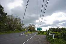
Turn off along Route 37, May 2006
Major intersections
The entire route is in Maui County.
| Location | mi[1] | km | Destinations | Notes | |
|---|---|---|---|---|---|
| | 0.0 | 0.0 | Road continues east as Route 31 | ||
| Kula | 9.8 | 15.8 | Southern terminus of Route 377 | ||
| Pukalani | 16.3 | 26.2 | Northern terminus of Route 377 | ||
| 16.9 | 27.2 | ||||
| Kahului | 24.1 | 38.8 | |||
| 1.000 mi = 1.609 km; 1.000 km = 0.621 mi | |||||
gollark: There's CraftOS-EFI, but it's not feature-complete.
gollark: I think it's mostly better to go for specific feature detection rather than version checks.
gollark: I have been known to use mobile telephony/computation apparatus.
gollark: For security and general sanity, PLEASE PLEASE PLEASE do not just go around sending packets over the network with all the related functions.
gollark: Do so. With every (useful) PR PotatOS grows stronger.
References
- Google (June 16, 2018). "Hawaii Route 37" (Map). Google Maps. Google. Retrieved June 16, 2018.
This article is issued from Wikipedia. The text is licensed under Creative Commons - Attribution - Sharealike. Additional terms may apply for the media files.