Hautepierre-le-Châtelet
Hautepierre-le-Châtelet is a former commune in the Doubs department in the Bourgogne-Franche-Comté region in eastern France.
Hautepierre-le-Châtelet | |
|---|---|
Part of Les Premiers-Sapins | |
Location of Hautepierre-le-Châtelet 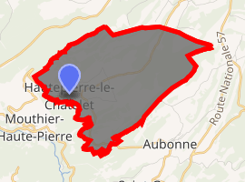
| |
 Hautepierre-le-Châtelet  Hautepierre-le-Châtelet | |
| Coordinates: 47°02′57″N 6°17′20″E | |
| Country | France |
| Region | Bourgogne-Franche-Comté |
| Department | Doubs |
| Arrondissement | Pontarlier |
| Canton | Valdahon |
| Commune | Les Premiers-Sapins |
| Area 1 | 9.61 km2 (3.71 sq mi) |
| Population (2017)[1] | 108 |
| • Density | 11/km2 (29/sq mi) |
| Time zone | UTC+01:00 (CET) |
| • Summer (DST) | UTC+02:00 (CEST) |
| Postal code | 25580 |
| Elevation | 710–903 m (2,329–2,963 ft) |
| 1 French Land Register data, which excludes lakes, ponds, glaciers > 1 km2 (0.386 sq mi or 247 acres) and river estuaries. | |
History
On 1 January 2016, Athose, Chasnans, Hautepierre-le-Châtelet, Nods, Rantechaux and Vanclans merged becoming one commune called Les Premiers-Sapins.
Population
| Year | Pop. | ±% |
|---|---|---|
| 1962 | 98 | — |
| 1968 | 103 | +5.1% |
| 1975 | 104 | +1.0% |
| 1982 | 102 | −1.9% |
| 1990 | 101 | −1.0% |
| 1999 | 80 | −20.8% |
| 2008 | 83 | +3.8% |
| 2012 | 103 | +24.1% |
gollark: I might just steal https://suricrasia.online/iceberg/ and swap out the text.
gollark: Iceberg implementation is actually moderately challenging.
gollark: Oh, that.
gollark: Python... incident?
gollark: If you think so, PLEASE SUBMIT THINGS TO PUT ON IT or you will not have.
See also
References
| Wikimedia Commons has media related to Hautepierre-le-Châtelet. |
| Authority control |
|
|---|
This article is issued from Wikipedia. The text is licensed under Creative Commons - Attribution - Sharealike. Additional terms may apply for the media files.