Haut-Ogooué Province
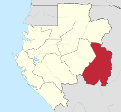
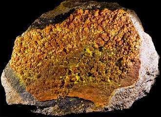
Haut-Ogooué is the southeastern-most of Gabon's nine provinces. It is named after the Ogooué River. It covers an area of 36,547 km². The provincial capital is Franceville. One of its primary industries is mining, with manganese, gold and uranium being found in the region. The uranium-bearing mineral Francevillite takes its name from the primary city. It is the historical home of three cultures, the Obamba, Ndzabi and Téké. Like many regions in Africa, more traditional uses of the land have given way to rural migration to the larger cities. In August 2006, its soccer club won the Gabon Independence Cup.
Haut-Ogooué | |
|---|---|
Province | |
 Haut-Ogooué Province in Gabon | |
| Coordinates: 1°38′S 13°35′E | |
| Country | |
| Capital | Franceville |
| Area | |
| • Total | 36,547 km2 (14,111 sq mi) |
| Population (2013) | |
| • Total | 250,799[1] |
| • Density | 6.9/km2 (18/sq mi) |
| HDI (2017) | 0.683[2] medium |
To the northeast, east, and south, Haut-Ogooué borders several regions of the Republic of the Congo:
- Cuvette-Ouest – northeast
- Cuvette – east
- Plateaux – southeast
- Lékoumou – south
- Niari – southwest
Domestically, it borders the following provinces:
- Ogooué-Lolo – west
- Ogooué-Ivindo – north
Departments

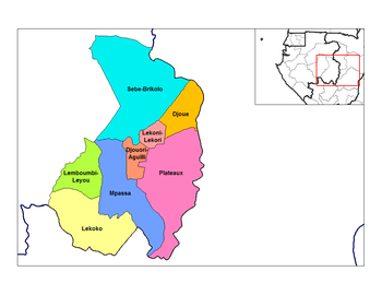
Haut-Ogooué is divided into 8 departments:
- Djoue Department (Onga)
- Djououri-Aguilli Department (Bongoville)
- Lekoni-Lekori Department (Akieni)
- Lekoko Department (Bakoumba)
- Lemboumbi-Leyou Department (Moanda)
- Mpassa Department (Franceville)
- Plateaux Department (Leconi)
- Sebe-Brikolo Department (Okondja)

References
- RESULTATS GLOBAUX DU RECENSEMENT GENERAL DE LA POPULATION ET DES LOGEMENTS DE 2013 DU GABON (PDF). Direction Générale de la Statistique. 2015. p. 6. Archived from the original (PDF) on 2016-10-13.
- "Sub-national HDI - Area Database - Global Data Lab". hdi.globaldatalab.org. Retrieved 2018-09-13.