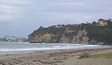
Hatfields Beach
Hatfields Beach, officially Ōtānerua / Hatfields Beach,[1] is a northern coastal suburb of Auckland, in New Zealand. It is on the Hibiscus Coast Highway about 40 kilometres (by road) north of the city centre.
Hatfields Beach | |
|---|---|
Suburb | |
| Country | New Zealand |
| Local authority | Auckland Council |
| Electoral ward | Albany Ward |
| Population (2018) | |
| • Total | 1,554 |
| Puhoi | Waiwera | |
|
|
(Hauraki Gulf) | |
| Wainui | Orewa |
The Hatfield family was established in what was then called Otenerua in 1859[2] and the area was known at Hatfield Bay by 1870.[3] Members of the family included John B Hatfield and his son, John Alexander Hatfield.[4]
The Auckland Unitary Plan proposes that the block to the north of Hatfields, between State Highway 1 and the Hibiscus Coast Highway, and south of the Waiwera River, which at the time the plan was produced was a mixture of native bush and marginal farmland, be redeveloped to include clusters of rural lifestyle blocks with protected areas and a walking trail to Waiwera.[5]
Demographics
| Year | Pop. | ±% p.a. |
|---|---|---|
| 2006 | 1,194 | — |
| 2013 | 1,380 | +2.09% |
| 2018 | 1,554 | +2.40% |
| Source: [6] | ||

Hatfields Beach had a population of 1,554 at the 2018 New Zealand census, an increase of 174 people (12.6%) since the 2013 census, and an increase of 360 people (30.2%) since the 2006 census. There were 558 households. There were 768 males and 786 females, giving a sex ratio of 0.98 males per female. The median age was 40.4 years, with 300 people (19.3%) aged under 15 years, 288 (18.5%) aged 15 to 29, 735 (47.3%) aged 30 to 64, and 225 (14.5%) aged 65 or older.
Ethnicities were 93.2% European/Pākehā, 11.6% Māori, 2.5% Pacific peoples, 3.5% Asian, and 1.4% other ethnicities (totals add to more than 100% since people could identify with multiple ethnicities).
The proportion of people born overseas was 29.0%, compared with 27.1% nationally.
Although some people objected to giving their religion, 58.5% had no religion, 31.7% were Christian, and 3.1% had other religions.
Of those at least 15 years old, 243 (19.4%) people had a bachelor or higher degree, and 183 (14.6%) people had no formal qualifications. The median income was $41,000. The employment status of those at least 15 was that 699 (55.7%) people were employed full-time, 222 (17.7%) were part-time, and 27 (2.2%) were unemployed.[6]
Notable residents
- Robert Muldoon, former Prime Minister, had a bach in Hatfields Beach, built by his father in law in 1959.[7]
Notes
- "Ngāti Whātua o Kaipara and the Crown - Deed of Settlement of Historical Claims" (PDF). New Zealand Government. 9 September 2011. p. 56.
- "Shipping Intelligence. Port of Auckland". Daily Southern Cross. 22 November 1859. p. 2.
- "Hatfield Bay". New Zealand Herald. 31 December 1870. p. 3.
- "Supreme Court. —Criminal Sittings". New Zealand Herald. 9 April 1874. p. 3.
- "I511 Hatfields Precinct" (PDF). Auckland Council. 8 May 2020.
- "Statistical area 1 dataset for 2018 Census". Statistics New Zealand. March 2020. Hatfields Beach (112800). 2018 Census place summary: Hatfields Beach
- Gustafson, Barry (2001). His Way: a Biography of Robert Muldoon. Auckland University Press. pp. 52, 101. ISBN 186940243X.