Gununah Parish, New South Wales
Gununah Parish located at 30.000833°S 141.977222°E is a remote rural locality and civil parish of Evelyn County, New South Wales in far northwest New South Wales.[1] located at 29°50′23″S 141°08′05″E. on the border with South Australia.
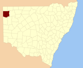
Map of Evelyn County.
Geography
The geography of the Parish is mostly the flat, arid landscape of the Channel Country. The parish has a Köppen climate classification of BWh (Hot desert).[2] The nearest town is Tibooburra to the north, which is on the Silver City Highway and lies south of the Sturt National Park.[3] The Parish itself is on the Silver City Highway where it meets Mount Brown Creek. Mount Brown Creek enters Bullea Lake some kilometers to the south.
gollark: Bytes are very nice, yes.
gollark: gollark.
gollark: I got access last year through a competition.
gollark: Also, when I gave it the source code of the first bit of my synthesiser program, it did the rest pretty much as I did.
gollark: I've made it do fun stuff like basic image manipulation (edge detection, dithering, etc) in JS, and it wrote a decent osmarkslisp™ given just the parser code I wrote.
References
- Map of the County of Evelyn : Western Division.
- Peel, M. C.; Finlayson, B. L.; McMahon, T. A. (2007). "Updated world map of the Köppen–Geiger climate classification". Hydrol. Earth Syst. Sci. 11: 1633–1644. doi:10.5194/hess-11-1633-2007. ISSN 1027-5606. (direct: Final Revised Paper)
- Olive Downs campground.
This article is issued from Wikipedia. The text is licensed under Creative Commons - Attribution - Sharealike. Additional terms may apply for the media files.