Gunahar Union
Gunahar union![]()

History
The union was formed in 1976.
Geography
The total area of this union is 7209 acres or 29.16 km2, located between Dupchanchia Upazila Sadar.
Administrative area
Gunnar union consists of a mouza / village. The mouza is divided into 9 administrative wards.

The villages are:
- Ward no. 1 – Atoil, Koigari, Jaroi, Boro Nilahaali, Beragram, Sorom.
- Ward no. 2 – Chhatny, Taluch, Pachusha
- Ward no. 3 – Chandimandap, Chhoto Karamji, Jhajira, Dangapara, Raghubarshipur.
- Ward no. 4 – Amjhupy, Gunahara, Palokuri, Bhanduriya.
- Ward no. 5 – Singa, Kamaru, Kazigari, Belhotti, Pukuragacha .
- Ward no. 6 – Arjunagari, Kurahar, keot, Choto Barram, Suhali.
- Ward no. 7 – Unahat, Bhatahar, Singra, Surzata
- Ward no. 8 – Khagra, Damkuri, Pouta, Merai.
- Ward no. 9 – Paogacha, Dochia, Bhathanda, Nurpur.

Each ward has an elected representative (council member). Again, there are elected women representatives (female members of the council) in every three wards. They are reporting the elected representatives (chairman of the council). The council also has one recruited secretary, ten village police and one entrepreneur.
Population
According to the 2011 census, the total population of Gunner union was 27,101,[2] of which 13,582 were male and 14,142 were female.
Education
The average literacy rate of Gunahar union is 50.0%. Among them, the rate of female literacy is 45.6% and the male literacy rate is 54.8%. Among the important educational institutions in this area.

Economics
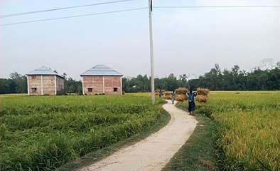
The economy of Gunahar Union is largely dependent on agriculture.
References
- "Rajshahi Division" (PDF). www.bbs.portal.gov.bd. Bangladesh Bureau of Statistics. July 2016.
- Population & Housing Census-2011 [Census 2011] (PDF) (Report). National report. Volume 2: Union Statistics. Dhaka: Bangladesh Bureau of Statistics. March 2017. Archived from the original (PDF) on 9 March 2016. Retrieved 21 February 2017.