Guirrari
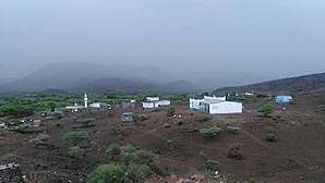
Guirrari (Arabic: غيراري) is a town in the northern Tadjourah region of Djibouti. Its population, with the nomadic and semi-nomadic neighborhoods is estimated at 500 people.
Guirrari غيراري | |
|---|---|
Town | |
 | |
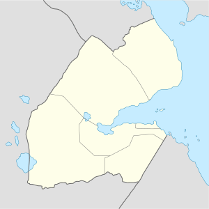 Guirrari غيراري Location in Djibouti | |
| Coordinates: 12°03′N 42°47′E | |
| Country | |
| Region | Tadjourah |
| Elevation | 831 m (2,726 ft) |
Agriculture
Guirrari is noted for its agricultural and farming industry. Crops grown in the area include vegetables and fruits. Significant investments have been made in the industry.
Climate
Guirrari has a hot semi-arid climate (BSh) in Köppen-Geiger system.
| Climate data for Guirrari | |||||||||||||
|---|---|---|---|---|---|---|---|---|---|---|---|---|---|
| Month | Jan | Feb | Mar | Apr | May | Jun | Jul | Aug | Sep | Oct | Nov | Dec | Year |
| Average high °C (°F) | 24.7 (76.5) |
24.9 (76.8) |
26.9 (80.4) |
28.9 (84.0) |
32.1 (89.8) |
35.3 (95.5) |
35.9 (96.6) |
35.0 (95.0) |
33.1 (91.6) |
29.7 (85.5) |
26.8 (80.2) |
25.0 (77.0) |
29.9 (85.7) |
| Average low °C (°F) | 14.2 (57.6) |
15.7 (60.3) |
17.6 (63.7) |
19.6 (67.3) |
22.1 (71.8) |
25.0 (77.0) |
24.7 (76.5) |
24.1 (75.4) |
23.8 (74.8) |
19.9 (67.8) |
17.0 (62.6) |
15.5 (59.9) |
19.9 (67.9) |
| Average precipitation mm (inches) | 28 (1.1) |
27 (1.1) |
19 (0.7) |
23 (0.9) |
12 (0.5) |
6 (0.2) |
20 (0.8) |
31 (1.2) |
31 (1.2) |
12 (0.5) |
32 (1.3) |
24 (0.9) |
265 (10.4) |
| Source: Climate-Data.org, altitude: 841m[1] | |||||||||||||
gollark: --radio disconnect
gollark: --radio connect
gollark: --magic reload_ext
gollark: --radio disconnect
gollark: Hmm. It is being suspiciously silent. This troubles me.
References
- "Climate: Guirrari - Climate graph, Temperature graph, Climate table". Climate-Data.org. Retrieved 25 September 2015.
This article is issued from Wikipedia. The text is licensed under Creative Commons - Attribution - Sharealike. Additional terms may apply for the media files.