Guatapurí
Guatapurí is a Colombian town and corregimiento of Valledupar in the Department of Cesar. Atanquez is located on the Sierra Nevada de Santa Marta mountain range at approximately 2,000 m over the sea level. Guatapurí is known for being predominantly inhabited by the indigenous ethnic group Kankuamos among others and mestizo groups.
Guatapurí | |
|---|---|
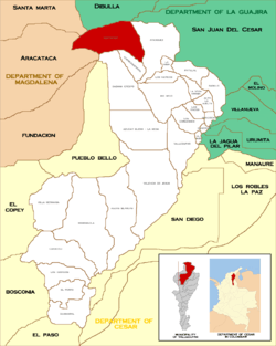 Location in the municipality of Valledupar. | |
| Country | Colombia |
| Department | Cesar |
| Municipality | Valledupar |
| Founded | Pre-Columbian |
| Government | |
| • Type | Corregimiento |
| Time zone | UTC-5 |
| Website | www.atanquez.com |
History
Historically, Guatapurí has been an area inhabited by the Arhuaco ethnic group, an Amerindian group. The name Guatapurí meaning "cold water" gives the name to the river that passes through its territory; the Guatapuri River.
Economy
The economy of Guatapurí is based on agriculture and the production of indigenous art crafts. The main products are panela, liquor from maize and sugar cane, fique, production of medicinal plants, local fruits and vegetables, Cacao and coffee which is commercialize in Valledupar.[1]
Notes
- Gutierrez Hinojosa 2000, p. 126
References
- Gutierrez Hinojosa, Tomas Dario (2000), Valledupar Musica de una Historia, Bogota: Editorial Grijalbo LTDA, ISBN 958-639-175-2