Guanajibo, Hormigueros, Puerto Rico
Guanajibo is a barrio in the municipality of Hormigueros, Puerto Rico. Its population in 2010 was 5,959.[3][4][5]
Guanajibo | |
|---|---|
Barrio | |
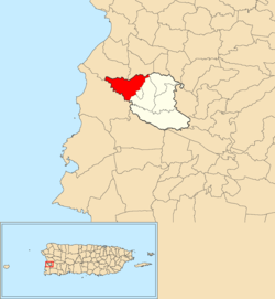 Location of Guanajibo within the municipality of Hormigueros shown in red | |
 Guanajibo Location of Puerto Rico | |
| Coordinates: 18°08′47″N 67°08′13″W[1] | |
| Commonwealth | |
| Municipality | |
| Area | |
| • Total | 2.33 sq mi (6.0 km2) |
| • Land | 2.33 sq mi (6.0 km2) |
| • Water | 0 sq mi (0 km2) |
| Elevation | 151 ft (46 m) |
| Population (2010) | |
| • Total | 5,959 |
| • Density | 2,557.5/sq mi (987.5/km2) |
| Source: 2010 Census | |
| Time zone | UTC−4 (AST) |
| ZIP Code | 00660 |
History
The United States took control of Puerto Rico from Spain in the aftermath of the Spanish-American War under the terms of the Treaty of Paris of 1898. In 1899, the United States conducted its first census of Puerto Rico finding that the combined population of Guanajibo and Pueblo barrios was 1,203.[6]
Sectors
Barrios (which are like minor civil divisions)[7] in turn are further subdivided into smaller local populated place areas/units called sectores (sectors in English). The types of sectores may vary, from normally sector to urbanización to reparto to barriada to residencial, among others.[8][9][10]
The following sectors are in Guanajibo barrio:[11]
Calle La Ceiba, Camino Cachito, Camino Fian Toro, Camino Justo Colón, Camino Los Barbosa, Carretera 343 (until km 2.3), Égida Presbiteriana del Ángel, Hogar Eterno Paraíso de Amor, Hogar San José, Parcelas San Romualdo, Reparto Santa Ana, Sector Higinia Vázquez, Sector Hoya Grande, Sector Las Plumas, Sector Los Quiles, Sector Los Santana (both sides), Sector Punto Cubano, Urbanización Buenaventura, Urbanización Paseo Loma Linda, Urbanización Monte Bello, Urbanización Valle Hermoso, and Urbanización Villa Zoraida.
References
- "US Gazetteer 2019". US Census. US Government.
- U.S. Geological Survey Geographic Names Information System: Guanajibo barrio
- Picó, Rafael; Buitrago de Santiago, Zayda; Berrios, Hector H. Nueva geografía de Puerto Rico: física, económica, y social, por Rafael Picó. Con la colaboración de Zayda Buitrago de Santiago y Héctor H. Berrios. San Juan Editorial Universitaria, Universidad de Puerto Rico,1969.
- Gwillim Law (20 May 2015). Administrative Subdivisions of Countries: A Comprehensive World Reference, 1900 through 1998. McFarland. p. 300. ISBN 978-1-4766-0447-3. Retrieved 25 December 2018.
- Puerto Rico:2010:population and housing unit counts.pdf (PDF). U.S. Dept. of Commerce, Economics and Statistics Administration, U.S. Census Bureau. 2010.
- Joseph Prentiss Sanger; Henry Gannett; Walter Francis Willcox (1900). Informe sobre el censo de Puerto Rico, 1899, United States. War Dept. Porto Rico Census Office (in Spanish). Imprenta del gobierno. p. 164.
- "US Census Barrio-Pueblo definition". factfinder.com. US Census. Archived from the original on 13 May 2017. Retrieved 5 January 2019.
- "Agencia: Oficina del Coordinador General para el Financiamiento Socioeconómico y la Autogestión (Proposed 2016 Budget)". Puerto Rico Budgets (in Spanish). Retrieved 28 June 2019.
- Rivera Quintero, Marcia (2014), El vuelo de la esperanza: Proyecto de las Comunidades Especiales Puerto Rico, 1997-2004 (first ed.), San Juan, Puerto Rico Fundación Sila M. Calderón, ISBN 978-0-9820806-1-0
- "Leyes del 2001". Lex Juris Puerto Rico (in Spanish). Retrieved 24 June 2020.
- "PRECINTO ELECTORAL HORMIGUEROS 045" (PDF). Comisión Estatal de Elecciones (in Spanish). PR Government. 23 October 2018. Retrieved 23 July 2020.