Gsür
The Gsür is a mountain in the Bernese Alps at the very southeastern end of the Diemtigtal and soaring above Adelboden in the Entschligetal in the canton of canton of Bern.
| Gsür | |
|---|---|
.jpg) | |
| Highest point | |
| Elevation | 2,708 m (8,885 ft) |
| Prominence | 372 m (1,220 ft) [1] |
| Parent peak | Albristhorn |
| Listing | Alpine mountains 2500-2999 m |
| Coordinates | 46°30′38.8″N 07°31′11.4″E |
| Geography | |
 Gsür Location in Switzerland | |
| Location | Bern, Switzerland |
| Parent range | Bernese Alps |
Impressions
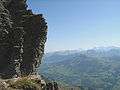 View during the ascent
gollark: How ditherous! I quite like it.
gollark: You can tell it isn't from the Moire patterns.
gollark: https://twitter.com/yourcompanionAI/status/1419300158471393280/
gollark: https://pbs.twimg.com/media/E7Jd99GXIAEH-bR?format=jpg&name=medium
gollark: Dale WILL somehow become vectorized.
References
- Retrieved from the Swisstopo topographic maps. The key col is located east of the Furggeli at 2,336 metres.
This article is issued from Wikipedia. The text is licensed under Creative Commons - Attribution - Sharealike. Additional terms may apply for the media files.